Saturday, February 24, 2018

Petrified Forest National Park (6-2)


[1. 簡介] [2. 旅遊建議/食宿交通] [3. Painted Desert] [4. Blue Mesa] [5. Petrified Forest] [6. Off the Beaten Path] [7. More about the Park] [8. Conclusion]


6. Off the Beaten Path

[6-1. Four Bridges] [6-2. Historic Blue Forest Trail] [6-3. Petroglyph Mesa] [6-4. Red Basin/Clam Beds] [6-5. First Forest Overlook] [6-6. Bidahochi] [6-7. Flattops Circumnavigation] [6-8. Siltstone] [6-9. Titanic] [6-10. Historic Rainbow Forest Road] [6-11. Haystacks] [6-12. Blue Mesa Walkabout] [6-13. Petroglyph Canyon] [6-14. Sorrel Horse Mesa] [6-15. Dead Wash Overlook] [6-16. Painted Desert Saunter] [6-17. Martha’s Butte & Beyond] [6-18. Third Forest] [6-19. Agate Mesa Ramble] [6-20. Wilderness Loop] [6-21. “Starving Man”] [6-22. Bear Spring]

6-2. Historic Blue Forest Trail

IMG_7434 Guided Off the Beaten Path Hike: Historic Blue Forest Trail
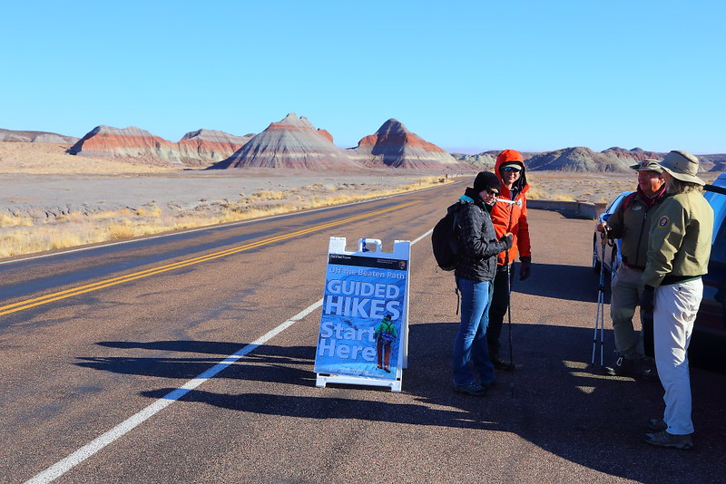
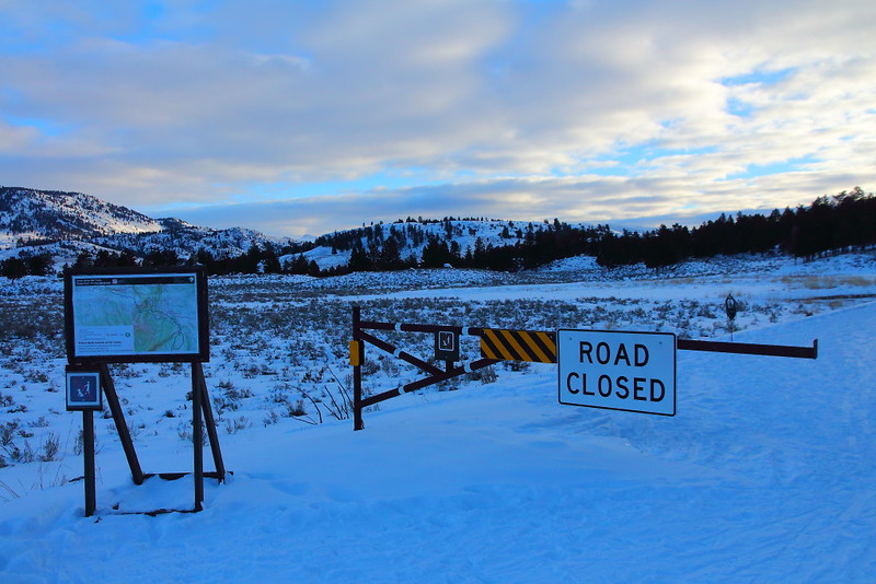
Figure 6-2.1: 這個guided hike的集合地點在The Tepees的路邊停車。

IMG_7435 Guided Off the Beaten Path Hike: Historic Blue Forest Trail
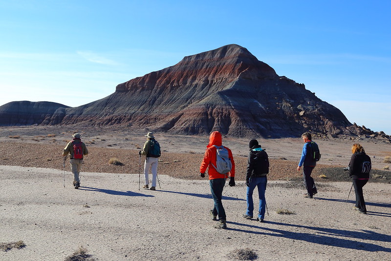
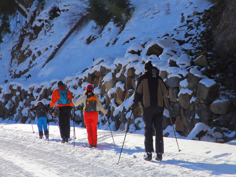
Figure 6-2.2: 帶隊的是Matt與Dorenda夫婦,跟團的連我共五個人。

IMG_7441 Erosion Landscape at the Teepees
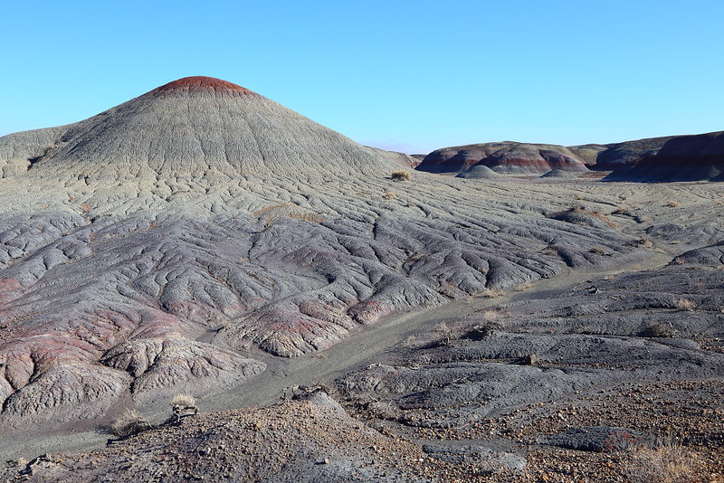
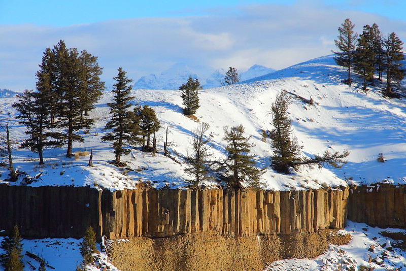
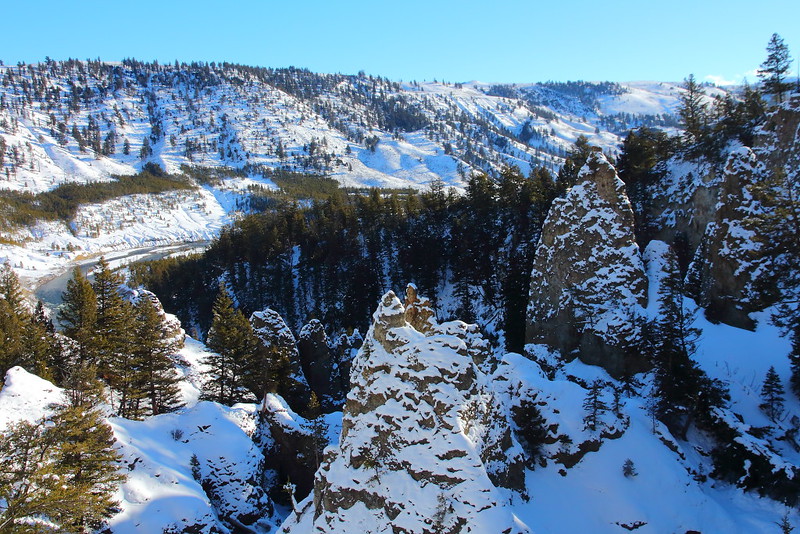
Figure 6-2.3: 這地形有點像是lava flow,但不是黑色而是紫色調就是。

IMG_7445 Guided Off the Beaten Path Hike: Historic Blue Forest Trail
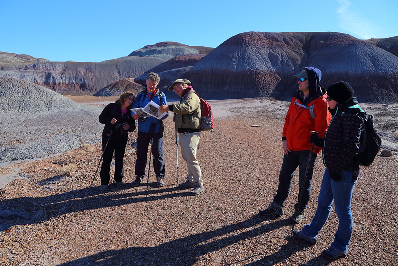
Figure 6-2.4: 這種跟團的都有解說,Matt還有準備歷史圖片跟現場對照。

IMG_7448 Guided Off the Beaten Path Hike: Historic Blue Forest Trail
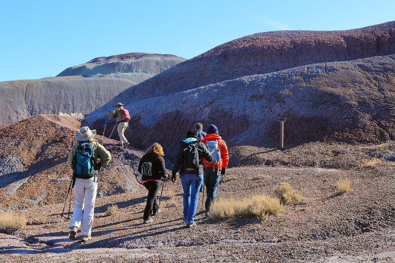
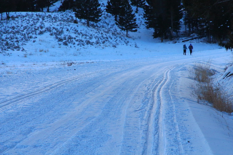
Figure 6-2.5: 這邊開始往上爬,之前走的是1930年代鋪設給車子開的平路。

IMG_7455 Guided Off the Beaten Path Hike: Historic Blue Forest Trail
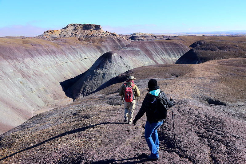
Figure 6-2.6: 一小段路就爬到上面,地形變得更有趣、或說是詭異。

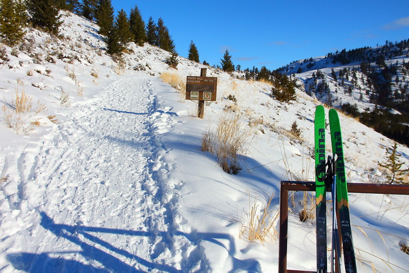
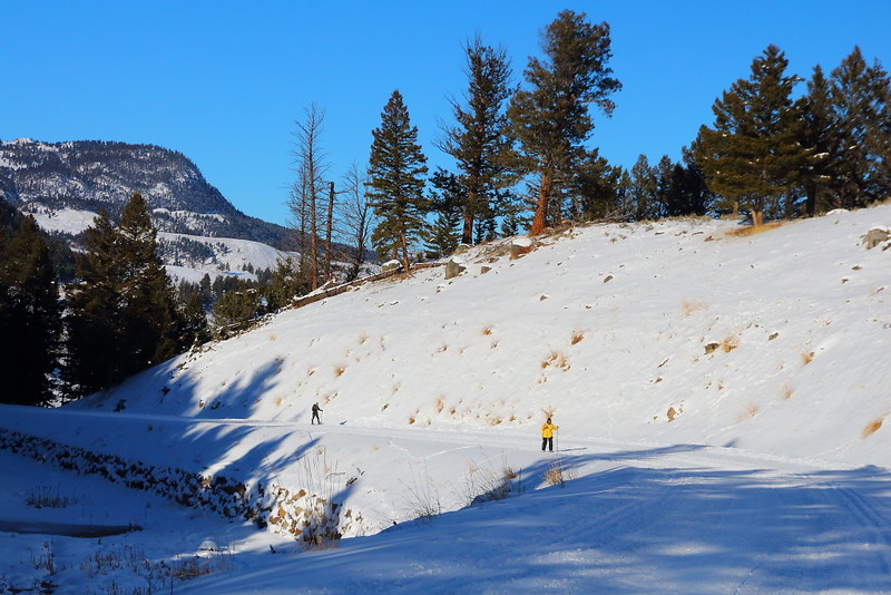
自從上次在感恩節參加了Four Bridges這個Off the Beaten Path的guided hike活動後,我就對要走到其他地方的類似活動很有興趣。原本打算在聖誕節左右到,不過臨時改變計畫,改成總統節到這。這個活動目前都選在週末的兩天舉行,並不是每天有。如果你也對這活動有興趣,在安排旅程的時候得配合一下。

原本想說可能又會看到上次帶隊Four Bridges的Gary與Connie夫妻,不過換成的是來自Iowa的Matt與Dorenda夫妻。他們是第二年冬天到這擔任volunteer,而在擔任Off the Beaten Path的帶隊hike前先接受過Gary的training。據他們所說,公園的這帶隊活動大都是地頭蛇Gary走出來的,之後傳授給其他的volunteer。所以雖然這次沒看到Gary,但他的精神還是一直陪伴著我。

IMG_7458 Blue Forest, Petrified Forest National Park
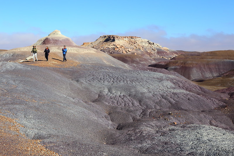
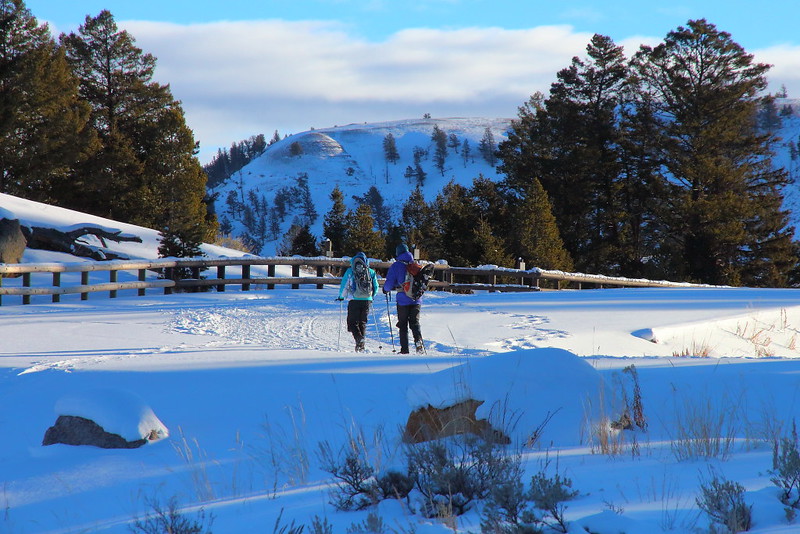
Figure 6-2.7: 小班制的hiking很casual,Dorenda跟另兩位來自德州的Gina與Don邊走邊聊天與照相。

IMG_7477 Sinking Ship from Blue Forest, Petrified Forest National Park
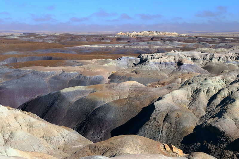
Figure 6-2.8: 看起來不像是地球上的風景,另一個叫做Titanic的帶隊活動會走到後面白色的那條岩石那邊。

IMG_7479 Badlands at Blue Forest
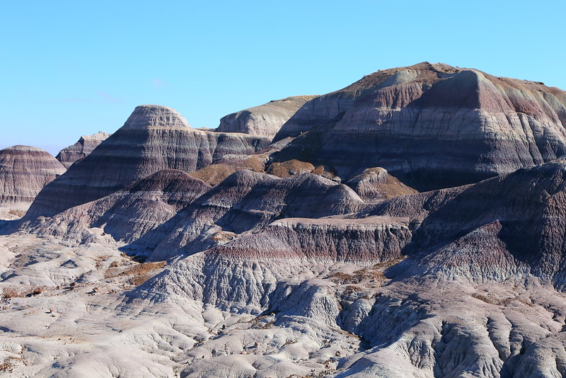
Figure 6-2.9: 紫色調的惡地地形。

IMG_7511 Petrified Wood
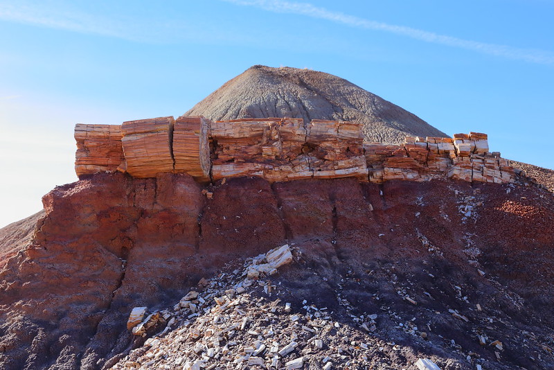
Figure 6-2.10: 一排被撐起的石化木。

IMG_7515 Guided Off the Beaten Path Hike: Historic Blue Forest Trail
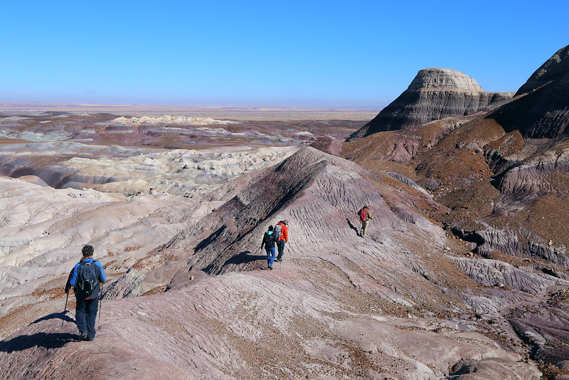
Figure 6-2.11: 這個帶隊的hike有不少得走在這種窄小步道的路段,上坡還好但下坡有些地方可能會有點可怕。

IMG_7535 Guided Off the Beaten Path Hike: Historic Blue Forest Trail
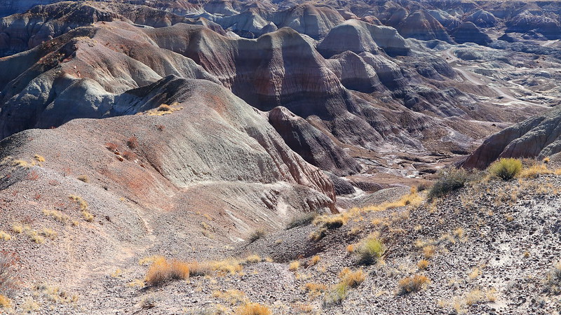
Figure 6-2.12: 這是最難走的下坡路段,從圖的左下方小小的步道以很斜的坡度走下去,會接到圖右上方鋪設的Blue Mesa Trail

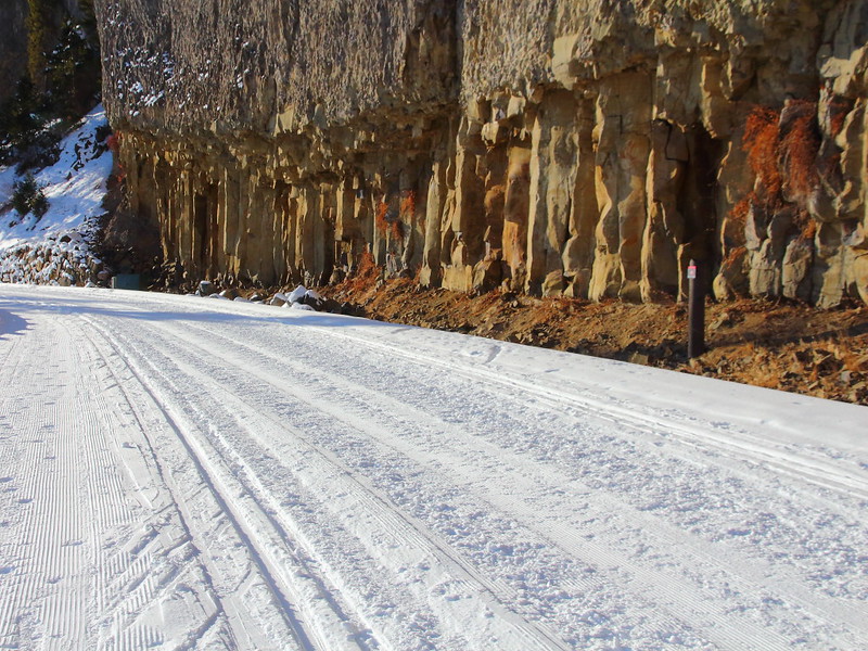
1930年代為了解決經濟大蕭條而成立的CCC (Civilian Conservation Corps)曾在這公園鋪設過不少馬路與步道,而Blue Forest是其中之一。大部分人在到達The Tepees時大都就路邊停車拍個照,但這裡其實有一條通往Blue Mesa方向的馬路,之後有Blue Forest這步道可以連接到Blue Mesa Trail

這段馬路與步道在1955年之後廢棄不用,由Blue Mesa Road與Blue Mesa Trail取代原先的功能。公園有不少段的馬路都在之後廢棄不用,其中一個原因是化石,而Blue Forest這區是化石的重點區域之一。除了恐龍,在公園找到的fresh water shark也被視為相當珍貴,因為目前的鯊魚大都在海水而不在淡水裡。

Matt與Dorenda也接受過古生物學家的化石training,有一次他們就檢了一顆很像是尋常石頭的化石給我們看,就他們的判斷是恐龍的一顆牙齒。反正他們就邊帶隊順便找,有看到化石或疑似是化石,就用GPS記下座標,之後報給公園的古生物學家。這些專家之後會走去,大部分的時候是已知的化石,但也有之前沒發現的就是。

IMG_7541 Historic Blue Forest Trail
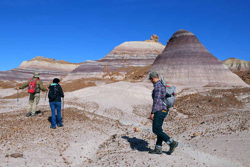
Figure 6-2.13: 這邊剛離開Blue Mesa Trail不久。

IMG_7548 Historic Blue Forest Trail
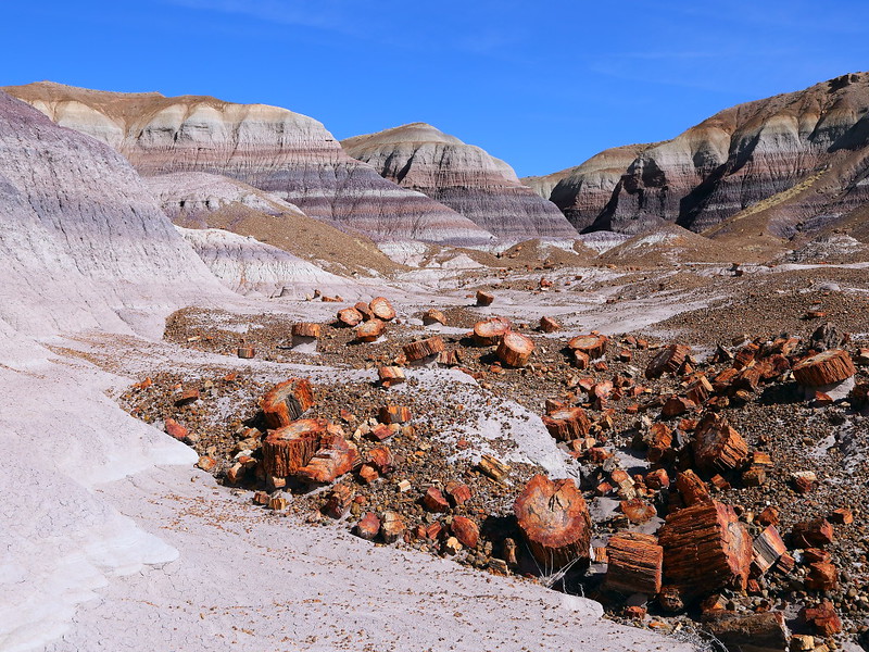
Figure 6-2.14: 一堆鮮豔的石化木。

IMG_7556 Guided Off the Beaten Path Hike: Historic Blue Forest Trail
Figure 6-2.15: 每個轉彎都有有趣的地形。

IMG_7561 Guided Off the Beaten Path Hike: Historic Blue Forest Trail
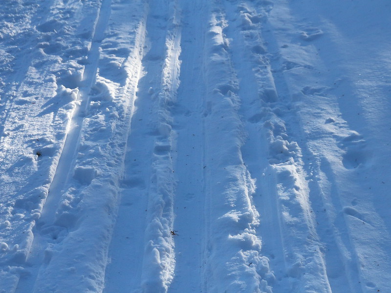
Figure 6-2.16: 地上的碎石是不少地方難走的原因,下坡會很滑而可能摔倒受傷,之前Figure 4-6.12的步道上就有這些鬼東西,上坡走會好一些,但不小心還是會滑。

IMG_7593 Guided Off the Beaten Path Hike: Historic Blue Forest Trail
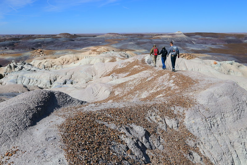
Figure 6-2.17: 這是往回走的路上,又回到外星球般的景色。

IMG_7597 Guided Off the Beaten Path Hike: Historic Blue Forest Trail
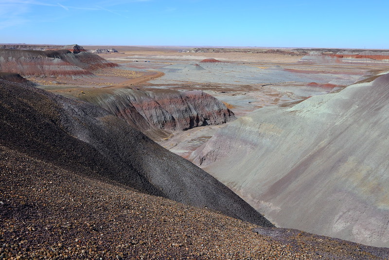
Figure 6-2.18: 走到這已經可以看到中間偏左停車的地方,大概十分鐘左右就可以回到馬路旁。

這個guided hike整趟走完大約3 miles,爬坡大概400 feet,看起來似乎很簡單,但因為地形基本面的關係,其實不少路段很不好走。不少地方有Figure 6-2.16的小石子,往下走的時候容易滑,萬一又是在很窄如Figure 6-2.12的下坡路段遇到,會非常struggle。實際上,在走完Figure 6-2.12到達鋪設好的Blue Mesa Trail時,Matt有問大家有沒有興趣順便走一圈Blue Mesa Trail?那一小段路顯然大家都去掉了快半條命,只想趕快往回走。

不管你是自己或是跟團走這公園的Off the Beaten Path,鞋子最好要好一點,走這個Blue Forest的步道可能還需要有hiking pole輔助。如果你自己沒有準備hiking pole,帶隊的人是有提供的。有空的話,我很推薦換個時間再走一趟,因為有的在早上逆光的角度在下午會變得很好看,反之亦然。

我對Blue Forest這步道的風景非常印象深刻,跟其他大咖的國家公園比起來可說是絲毫不遜色,至少在詭異風格這方面可說是相當突出。Blue Mesa這區域比較有高低起伏,可能是公園裡地形最精彩的地方。這區域還有一個可以到達Figure 6-2.8裡叫做鐵達尼號的帶隊Off the Beaten Path活動,我自己是相當有興趣參加,希望可以找到時間成行。

Previous Next


[6-1. Four Bridges] [6-2. Historic Blue Forest Trail] [6-3. Petroglyph Mesa] [6-4. Red Basin/Clam Beds] [6-5. First Forest Overlook] [6-6. Bidahochi] [6-7. Flattops Circumnavigation] [6-8. Siltstone] [6-9. Titanic] [6-10. Historic Rainbow Forest Road] [6-11. Haystacks] [6-12. Blue Mesa Walkabout] [6-13. Petroglyph Canyon] [6-14. Sorrel Horse Mesa] [6-15. Dead Wash Overlook] [6-16. Painted Desert Saunter] [6-17. Martha’s Butte & Beyond] [6-18. Third Forest] [6-19. Agate Mesa Ramble] [6-20. Wilderness Loop] [6-21. “Starving Man”] [6-22. Bear Spring]

[1. 簡介] [2. 旅遊建議/食宿交通] [3. Painted Desert] [4. Blue Mesa] [5. Petrified Forest] [6. Off the Beaten Path] [7. More about the Park] [8. Conclusion]

Saturday, February 10, 2018

Yellowstone National Park (4-12)


[1. 簡介] [2. 旅遊建議/食宿交通] [3. Sightseeing] [4. Winter Activities] [5. Wildlife Watching] [6. Day Hiking] [7. Other Activities] [8. Who's Who in the Park] [9. More about the Park] [10. 感想]


4. Winter Activities

[4-1. Flagg Ranch to Old Faithful] [4-2. Old Faithful to Mammoth Hot Springs] [4-3. Wildlife Tour] [4-4. Mammoth Hot Springs to Old Faithful] [4-5. Old Faithful/Upper Geyser Basin] [4-6. Grand Prismatic Spring Overlook] [4-7. Canyon Tour] [4-8. Old Faithful to Flagg Ranch] [4-9. Upper Terrace Drive] [4.10. Guided Snowmobile Canyon Tour] [4.11. Snowmobile Tour from Old Faithful] [4-12. XC Skiing: Tower Fall] [4-13. XC Skiing: Lone Star Geyser] [4-14. XC Skiing: Fairy Falls]

4-12. XC Skiing: Tower Fall

IMG_7666 Tower Fall Ski Trail, Yellowstone National Park
Figure 4-12.1: 早上過了九點到達雪道起點。

IMG_7669 Tower Fall Ski Trail
Figure 4-12.2: 除了我之外的另一組人,不過他們是背著snowshoe做hiking。

IMG_7671 Tower Fall Ski Trail
Figure 4-12.3: 日出時間大概是八點,不過因為地形阻擋與天空雲較多的關係,九點多看起來還不是很亮。

IMG_7684 Tower Fall Ski Trail
Figure 4-12.4: 雪道旁的ㄧ隻bison,cross country skiing的人下坡時得小心控制速度,這動物是可能走到雪道上的。

IMG_7690 Tower Fall Ski Trail
Figure 4-12.5: 雪道上的track有很多被腳踩過的痕跡,可說是沒公德心......咦,這腳印看起來不像是人的。這是bison的腳印,他們顯然不清楚公德心是甚麼東西,可說是在這公園裡滑雪最不同或是危險之處。

IMG_7699 Tower Fall Ski Trail
Figure 4-12.6: 這地方大約是雪道的中點,可以走去聊望台看Calcite Springs與黃石大峽谷。

IMG_7725 Calcite Springs Overlook, Yellowstone National Park
Figure 4-12.7: 冒煙的就是峽谷底部的Calcite Springs,Yellowstone River蜿蜒流過。

IMG_7731 Basalt Columns
Figure 4-12.8: 這個是玄武岩柱。

Yellowstone的冬天能做的事情很多,cross country skiing,也就是越野滑雪是其中的ㄧ項。在公園的北邊,梯田區的Upper Terrace Drive與位於Tower Junction的Tower Fall都很適合這領域的初學者。如果cross country skiing不是你能做的,也可以用snowshoeing進行。

Tower Fall Ski Trail基本上是夏天的馬路,冬天的時候groom而不plow,提供給雙腿萬能外加不怕冷的人一個活動空間。來回Tower Fall的距離是5 miles,路面有groomed與tracks,上下坡度緩,屬於容易的滑雪道,正常人應該是可以在二到三小時內完成。除了終點的Tower Fall,大概在雪道的中點還有個眺望Calcite Springs的地方,算是投資報酬率不錯的雪道。

以cross country skiing的方式到Tower Fall是在公園進行冬季活動一個相當好的初嘗試,不過如果你覺得來回5 miles的Tower Fall還不是你能應付的,也許可以先嘗試梯田區更短距離的Upper Terrace Drive,或是Rendezvous Ski Trails這類的groomed trail system。

IMG_7758 Tower Fall Ski Trail
Figure 4-12.9: 夏天開車經過這時對路邊的這些岩壁可能會有些印象。

IMG_7776 Tower Fall Ski Trail
Figure 4-12.10: 到Tower Fall的最後一段路,可以繼續用滑的,但我是覺得脫下skis用走的比較安全。

IMG_8975 Tower Fall, Yellowstone National Park
Figure 4-12.11: 結了不少冰的Tower Fall。

IMG_9051 Half Frozen Tower Fall
Figure 4-12.12: Tower Fall與旁邊的結冰結構。

IMG_7819 Tower Fall Ski Trail
Figure 4-12.13: 往Tower Fall與Yellowstone River的上游望去。

IMG_7831 Tower Fall Ski Trail, Yellowstone National Park
Figure 4-12.14: 回程時看到的ㄧ家四口。

IMG_7834 Tower Fall Ski Trail
Figure 4-12.15: 大概要到接近中午時人才會開始比較多。

IMG_7842 Tower Fall Ski Trail, Yellowstone National Park
Figure 4-12.16: 回到起點,離中午十二點大約還有廿分鐘。

這是我第二次冬天滑到Tower Fall,上一次是在兩年前差不多的時間。這次的雪量較少,溫度也較暖,雪道狀況稍微差一點,有些地方poles往下插還會碰到地面。我自己是有雪具,不過帶雪具坐飛機到這邊很麻煩,所以都是在Mammoth Hot Springs Hotel租半天然後開車到這滑。如果你沒車或是不想自己開車到這,這旅館有提供付費的ski shuttle接送。

Tower Fall會是甚麼樣子跟當時的溫度狀況有關,我第一次到的時候是全部結冰,也就是Figure 4-12.12的水前面有一層冰,但看得到冰後有水在流,不幸相片很難表現出這種視覺效果。這次比較暖,所以瀑布只是半結冰。

在Yellowstone搞cross country skiing或snowshoeing可能會遇到bison,我兩次滑這雪道都有看到bison,不過第一次他們在比較遠的地方,不像這次直接在雪道旁邊。雖然滑雪時看到野生動物是件有趣且特別的經驗,但如果他們走到雪道上而你無法控制自己,後果可能會很可怕,這也包括在Old Faithful那區滑雪,經驗上從Morning Glory Pool往Biscuit Geyser Basin的雪道上也常有bison出沒,時間剛好的話還會出現滑到一半被一群bison包圍的情形,相當驚險刺激。

Yellowstone可能是從事雪上活動最有野味的地方,如果cross country skiing還不是你能做的,是可以用snowshoeing,仍然可以體驗這種感覺。

Previous Next

[4-1. Flagg Ranch to Old Faithful] [4-2. Old Faithful to Mammoth Hot Springs] [4-3. Wildlife Tour] [4-4. Mammoth Hot Springs to Old Faithful] [4-5. Old Faithful/Upper Geyser Basin] [4-6. Grand Prismatic Spring Overlook] [4-7. Canyon Tour] [4-8. Old Faithful to Flagg Ranch] [4-9. Upper Terrace Drive] [4.10. Guided Snowmobile Canyon Tour] [4.11. Snowmobile Tour from Old Faithful] [4-12. XC Skiing: Tower Fall] [4-13. XC Skiing: Lone Star Geyser] [4-14. XC Skiing: Fairy Falls]

[1. 簡介] [2. 旅遊建議/食宿交通] [3. Sightseeing] [4. Winter Activities] [5. Wildlife Watching] [6. Day Hiking] [7. Other Activities] [8. Who's Who in the Park] [9. More about the Park] [10. 感想]

Thursday, February 1, 2018

Yellowstone National Park (5-12)


[1. 簡介] [2. 旅遊建議/食宿交通] [3. Sightseeing] [4. Winter Activities] [5. Wildlife Watching] [6. Day Hiking] [7. Other Activities] [8. Who's Who in the Park] [9. More about the Park] [10. 感想]


5. Wildlife Watching

[5-1. Grizzly Bear at Dunraven Pass] [5-2. Black Bear Watching] [5-3. Wolf/Grizzly Bear/Coyote in Hayden Valley] [5-4. Wolf/Grizzly Bear in Lamar Valley] [5-5. Elk in Rut at Mammoth Hot Springs] [5-6. Coyote at Lower Geyser Basin] [5-7. Bighorn Sheep at Gardner River Canyon] [5-8. Lamar Canyon Pack] [5-9. Pronghorn in Rut] [5-10. Red Fox] [5-11. Trumpeter Swan] [5-12. American Dipper] [5-13. White Wolf] [5-14. Violet-Green Swallow] [5-15. Mountain Goat] [5-16. Moose] [5-17. Great Gray Owl] [5-18. Wapiti Lake Pack] [5-19. Osprey above Lamar River] [5-20. Young Grizzly Bear by Obsidian Creek] [5-21. Bull Elk at Grand Canyon] [5-22. Bighorn Sheep at Yellowstone River Picnic Area]

5-12. American Dipper

美洲河鳥,也就是American dipper,算是隻小小鳥,通常出現在湖或是河流,獵食所謂的aquatic insect。這鳥分布在北美西部的廣大區域,並不限於在Yellowstone。在公園裡,這是四季都看得到的鳥,不過我大都是在冬天看到他們,包括Firehole River、Yellowstone River與公園北邊Lamar Valley馬路旁的Soda Butte Creek。

冬天大部分的湖與河都結冰,只有地熱區比如Firehole River或是一些水流較湍急的地方很難結冰,也是可能看到這鳥與其他(水)鳥的地方。

IMG_9988 American Dipper, Yellowstone National Park
Figure 5-12.1: 在Iron Creek上的ㄧ隻dipper。

IMG_0013 American Dipper, Yellowstone National Park
Figure 5-12.2: 很少可以在這麼近的距離觀察dipper這鳥。

IMG_0034 American Dipper
Figure 5-12.3: 有時候會站到水流較湍急的地方。

IMG_0037 American Dipper, Yellowstone National Park
Figure 5-12.4: 鑽頭到水裡找東西吃。

IMG_0048 American Dipper, Yellowstone National Park
Figure 5-12.5: 另一個鑽頭到水裡的動作。

IMG_0022 American Dipper, Yellowstone National Park
Figure 5-12.6: 拍翅膀時產生的小水珠。

這次是在Black Sand Geyser Basin的Iron Creek看到這鳥,Iron Creek就是流過Cliff Geyser前的那條河。從Old Faithful沿著Castle Geyser與Morning Glory Pool的那條路走到這大概是2 miles,來回就是4 miles,說近不近,說遠不遠。我走到這當然不是為了要看鳥,不過既然這鳥如此合作,當然就順便一下。

這鳥顏色上並不討好,甚至很黯淡,但吸引人之處在於他的覓食行為。很多時候看到的是他在河邊走動與觀望,然後忽然整隻鑽到水裡,之後又回到岸邊。不過這次倒是較沒看到這典型的行為,這鳥花了不少時間走在岸邊尋找食物,也有一些時候站到河裡的石頭上,之後把頭鑽到水裡覓食。以這體型與水的流速,總覺得會被水沖走,但他一直是自我感覺良好專心地在拼經濟,水流一點都不困擾到他。

我也常在冬天Lamar Valley裡馬路邊的Soda Butte Creek看到這鳥,不過距離遠了很多,除非你有更好的長鏡頭,圖片的效果大都很有限。

Previous Next


[5-1. Grizzly Bear at Dunraven Pass] [5-2. Black Bear Watching] [5-3. Wolf/Grizzly Bear/Coyote in Hayden Valley] [5-4. Wolf/Grizzly Bear in Lamar Valley] [5-5. Elk in Rut at Mammoth Hot Springs] [5-6. Coyote at Lower Geyser Basin] [5-7. Bighorn Sheep at Gardner River Canyon] [5-8. Lamar Canyon Pack] [5-9. Pronghorn in Rut] [5-10. Red Fox] [5-11. Trumpeter Swan] [5-12. American Dipper] [5-13. White Wolf] [5-14. Violet-Green Swallow] [5-15. Mountain Goat] [5-16. Moose] [5-17. Great Gray Owl] [5-18. Wapiti Lake Pack] [5-19. Osprey above Lamar River] [5-20. Young Grizzly Bear by Obsidian Creek] [5-21. Bull Elk at Grand Canyon] [5-22. Bighorn Sheep at Yellowstone River Picnic Area]

[1. 簡介] [2. 旅遊建議/食宿交通] [3. Sightseeing] [4. Winter Activities] [5. Wildlife Watching] [6. Day Hiking] [7. Other Activities] [8. Who's Who in the Park] [9. More about the Park] [10. 感想]