Thursday, September 24, 2020

Yellowstone National Park (6-22)


[1. 簡介] [2. 旅遊建議/食宿交通] [3. Sightseeing] [4. Winter Activities] [5. Wildlife Watching] [6. Day Hiking] [7. Other Activities] [8. Who's Who in the Park] [9. More about the Park] [10. 感想]

6. Day Hiking

[6-1. Mount Washburn] [6-2. Artists Paintpots] [6-3. Trails at the Grand Canyon of the Yellowstone] [6-4. Natural Bridge] [6-5. Ranger-Led Hike: Lupine Loop Walk] [6-6. Mystic Falls] [6-7. Bunsen Peak] [6-8. Beaver Ponds Loop] [6-9. Lone Star Geyser] [6-10. The Hoodoos] [6-11. Petrified Trees of Specimen Ridge] [6-12. Pelican Creek Nature Trail] [6-13. Cascade Lake] [6-14. Monument Geyser Basin] [6-15. Fairy Falls/Imperial Geyser] [6-16. Elephant Back Mountain] [6-17. Hellroaring Creek] [6-18. Yellowstone River Overlook] [6-19. Trout Lake] [6-20. Riddle Lake] [6-21. Point Sublime] [6-22. Storm Point] [6-23. Lake Overlook] [6-24. Wraith Falls] [6-25. Little Gibbon Falls] [6-26. Osprey Falls] [6-27. Narrow Gauge Terrace] [6-28. Slough Creek] [6-29. Harlequin Lake]

6-22. Storm Point

IMG_5525 Storm Point Trail
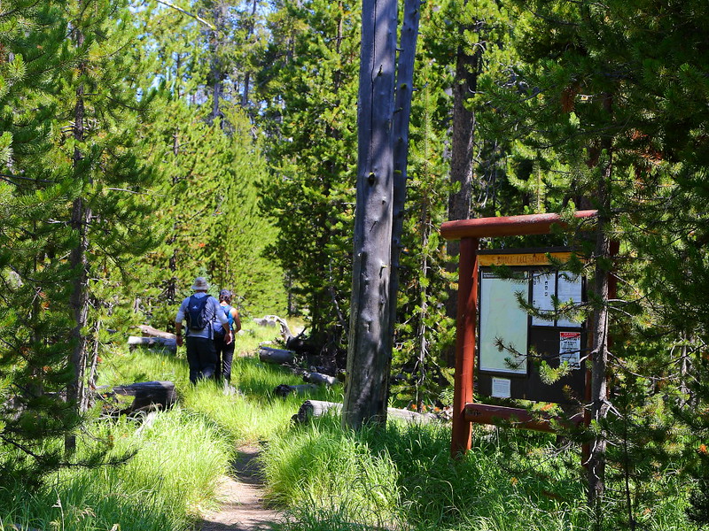
Figure 6-22.1: Storm Point的步道口。

IMG_5529 Storm Point Trail
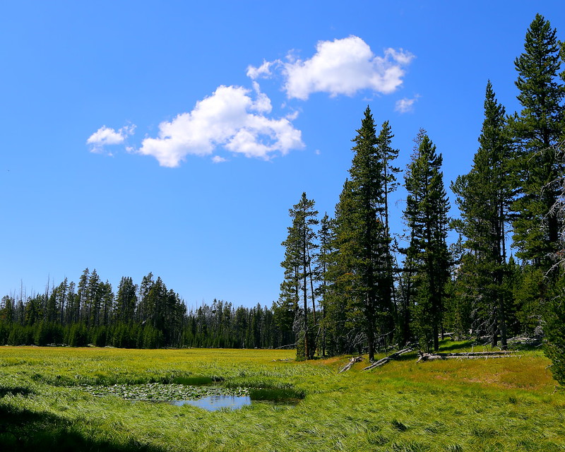
Figure 6-22.2: 太陽在雲間穿梭,地上時亮時暗。

IMG_5536 Storm Point Trail, Yellowstone National Park
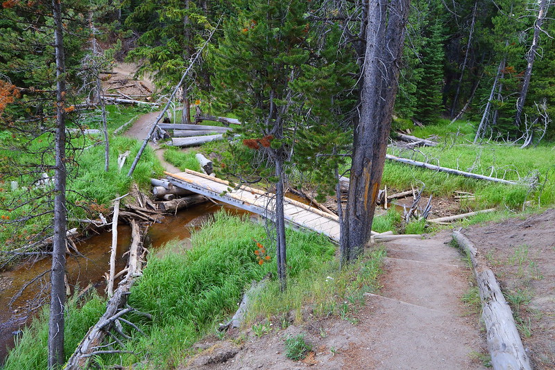
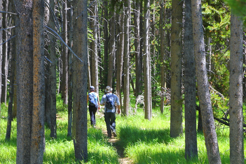
Figure 6-22.3: 到達Storm Point前得穿過一片樹林。

IMG_5543 Storm Point Trail
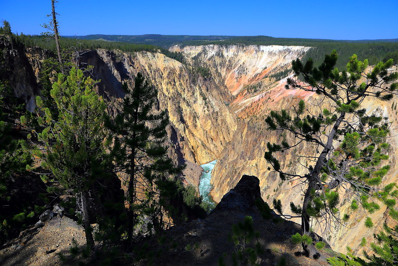
Figure 6-22.4: 穿過樹林後會看到Yellowstone Lake,往前走不久就是Storm Point。

IMG_5556 Yellowstone Lake from Storm Point Trail
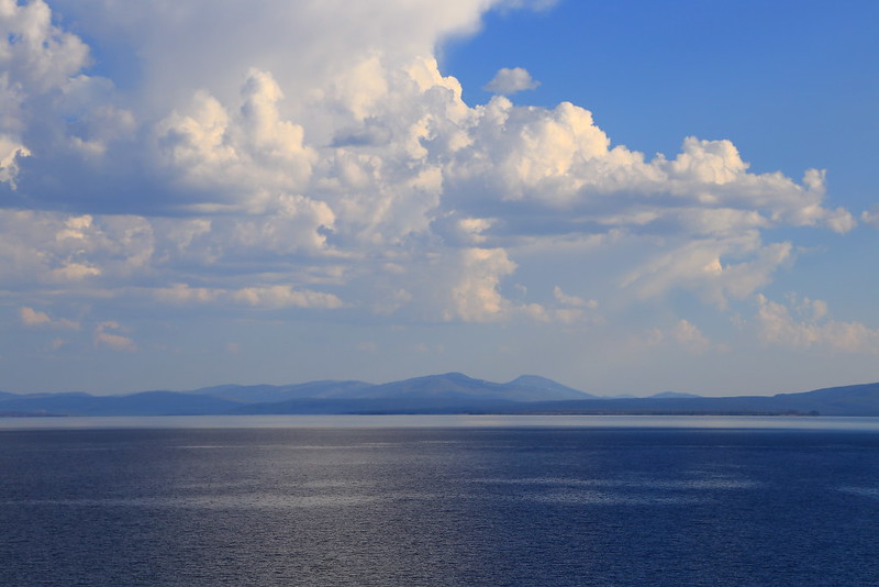
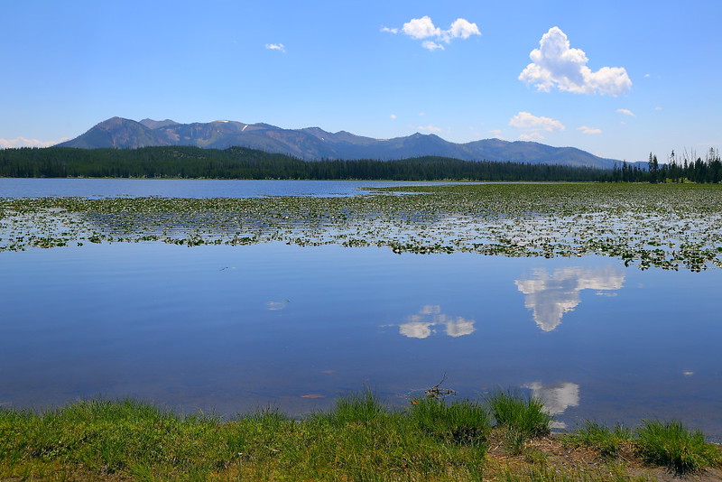
Figure 6-22.5: Yellowstone Lake很大,看起來像是遠方有山的海。

IMG_5549 Storm Point Trail
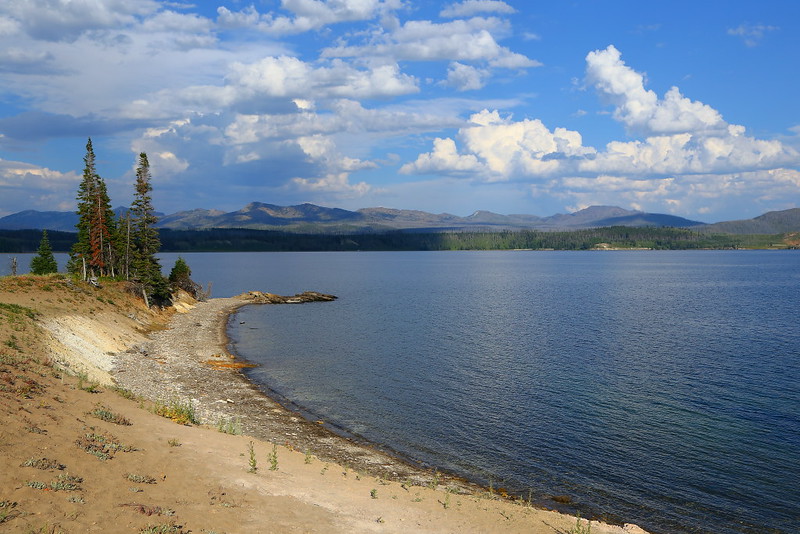
Figure 6-22.6: 離開Storm Point沿著湖邊走一小段路後看到的景色,背景的山是Absaroka Range。

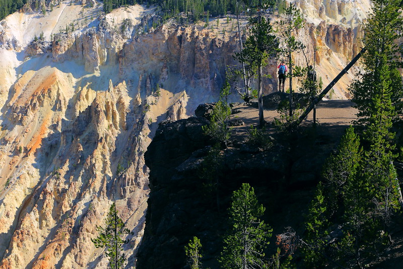
Storm Point是Yellowstone Lake湖邊的一個眺望點,可以靠一個來回約2 miles的步道到達,步道口在往East Entrance的路上,大概在離Fishing Bridge約五分鐘車程的地方,就在Pelican Creek Nature Trail步道口的下一個路邊停車。

這步道可以視為是Pelican Creek Nature Trail的加長版,調調也很像,沒甚麼坡度且不少路段都有lodgepole pine的樹林遮陽,所以算是個很適合親子同遊的步道。在走了一段視野開闊的路後會進入樹林,之後會走一個loop到Storm Point欣賞Lake Yellowstone的湖光山色,然後沿著湖岸走一段路後回到樹林完成這個loop,再走原路回到步道口。

能看到Yellowstone Lake的地方不少,我不覺得Storm Point這地方有任何特別之處,踏青的成分大於欣賞美景,屬於舒服好走的步道。話雖如此,當時走在樹林時被蚊子騷擾,即使當時已經是八月且是下午較熱的時間;回程時更嚴重,只能快步走動趕快逃離樹林。

IMG_5577 Storm Point Trail, Yellowstone National Park
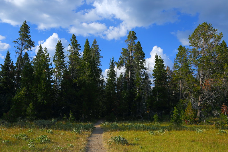
Figure 6-22.7: 回程得重新走進樹林。

IMG_5593 Lodgepole Pine Forest on Storm Point Trail
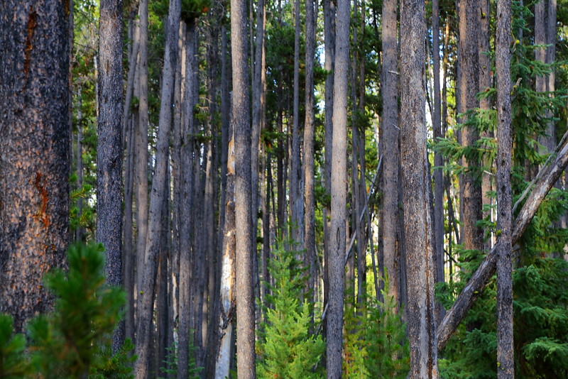
Figure 6-22.8: 樹林裡的樹大都是lodgepole pine。

IMG_5603 Storm Point Trail, Yellowstone National Park
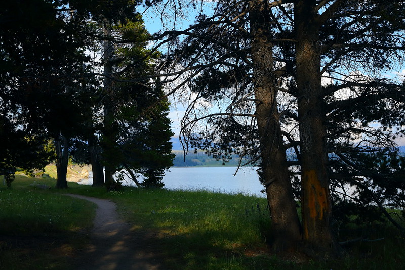
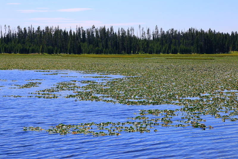
Figure 6-22.9: 樹林旁的Yellowstone Lake。

IMG_5615 Storm Point Trail
Figure 6-22.10: 這地方正要完全走出樹林,這時太陽已從雲間穿出。

IMG_5634 Indian Pond, Yellowstone National Park
Figure 6-22.11: Indian Pond上的倒影。

IMG_5644 Indian Pond, Yellowstone National Park
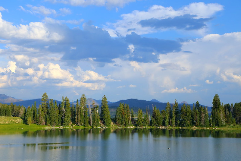
Figure 6-22.12: Indian Pond就在步道口,剛開始走的時候沒有陽光,回程時太陽出來比較好看。

即使這步道不長,一個人走還是有遇到grizzly bear的顧忌,步道上能夠遇到多一點人還是比較保險,即使隨身有攜帶bear spray。開始走的時間大概是五點,步道上還剩幾輛車子,想說應該還可以而決定走這一趟。結果在loop開始前的樹林裡遇到一組人後就都沒遇到人,早個十分鐘出發應該會好很多,不至於成為步道上最後一個人。

公園在這步道有舉辦ranger-led hike,今年因為疫情當然取消了這類的群聚活動。雖然這並不是個非走不可的步道,但可以當作是個備案,陰錯陽差下也許會派上用場。

Previous Next


[6-1. Mount Washburn] [6-2. Artists Paintpots] [6-3. Trails at the Grand Canyon of the Yellowstone] [6-4. Natural Bridge] [6-5. Ranger-Led Hike: Lupine Loop Walk] [6-6. Mystic Falls] [6-7. Bunsen Peak] [6-8. Beaver Ponds Loop] [6-9. Lone Star Geyser] [6-10. The Hoodoos] [6-11. Petrified Trees of Specimen Ridge] [6-12. Pelican Creek Nature Trail] [6-13. Cascade Lake] [6-14. Monument Geyser Basin] [6-15. Fairy Falls/Imperial Geyser] [6-16. Elephant Back Mountain] [6-17. Hellroaring Creek] [6-18. Yellowstone River Overlook] [6-19. Trout Lake] [6-20. Riddle Lake] [6-21. Point Sublime] [6-22. Storm Point] [6-23. Lake Overlook] [6-24. Wraith Falls] [6-25. Little Gibbon Falls] [6-26. Osprey Falls] [6-27. Narrow Gauge Terrace] [6-28. Slough Creek] [6-29. Harlequin Lake]

[1. 簡介] [2. 旅遊建議/食宿交通] [3. Sightseeing] [4. Winter Activities] [5. Wildlife Watching] [6. Day Hiking] [7. Other Activities] [8. Who's Who in the Park] [9. More about the Park] [10. 感想]

Wednesday, September 16, 2020

Yellowstone National Park (6-21)


[1. 簡介] [2. 旅遊建議/食宿交通] [3. Sightseeing] [4. Winter Activities] [5. Wildlife Watching] [6. Day Hiking] [7. Other Activities] [8. Who's Who in the Park] [9. More about the Park] [10. 感想]

6. Day Hiking

[6-1. Mount Washburn] [6-2. Artists Paintpots] [6-3. Trails at the Grand Canyon of the Yellowstone] [6-4. Natural Bridge] [6-5. Ranger-Led Hike: Lupine Loop Walk] [6-6. Mystic Falls] [6-7. Bunsen Peak] [6-8. Beaver Ponds Loop] [6-9. Lone Star Geyser] [6-10. The Hoodoos] [6-11. Petrified Trees of Specimen Ridge] [6-12. Pelican Creek Nature Trail] [6-13. Cascade Lake] [6-14. Monument Geyser Basin] [6-15. Fairy Falls/Imperial Geyser] [6-16. Elephant Back Mountain] [6-17. Hellroaring Creek] [6-18. Yellowstone River Overlook] [6-19. Trout Lake] [6-20. Riddle Lake] [6-21. Point Sublime] [6-22. Storm Point] [6-23. Lake Overlook] [6-24. Wraith Falls] [6-25. Little Gibbon Falls] [6-26. Osprey Falls] [6-27. Narrow Gauge Terrace] [6-28. Slough Creek] [6-29. Harlequin Lake]

6-21. Point Sublime

IMG_5001 Point Sublime Trail
Figure 6-21.1: 黃石大峽谷區域的地圖,Point Sublime可以從Artist Point走一條步道到達。

IMG_5010 Point Sublime Trail
Figure 6-21.2: 在Artist Point附近的Point Sublime路牌。

IMG_5015 Grand Canyon of the Yellowstone
Figure 6-21.3: 步道上其中一個黃石大峽谷景色。

IMG_5043 Point Sublime Trail, Yellowstone National Park
Figure 6-21.4: 不要太早或太晚走的話,還算容易在步道上看到人。

Point Sublime是公園在黃石大峽谷區域的一條短步道,可以從South Rim看到這峽谷的其他景色。步道的起點就在South Rim的熱門景點Artist Point,大部分的遊客從停車場走到這會左轉到Artist Point照照相,之後走回車上前往下一個景點。如果你有多一點時間且想簡單走走,Point Sublime是個可以考慮的地點,雖然我覺得終點看起來不太sublime。

這步道的來回只有2 miles,加上坡度非常緩,除非體力實在太差或是腳有傷,要完成這段簡單的步道可以說是一塊蛋糕,大概可以在一小時內完成。如果你有更多的時間,可以考慮從叉路走到Clear Lake到Wapiti Lake的步道口,之後沿著South Rim Trail回到Artist Point的停車場,這樣整圈大概是4 miles,大概需要二小時或二個半小時。

據說黃石大峽谷與Hayden Valley是夏天grizzly bear比較喜歡活動的區域,加上是一個人走,所以我刻意在接近十點時才開始走,也如我預期在步道上三不五時就會遇到人,在免於恐懼的狀況下很輕鬆地走到終點Point Sublime。回程時的人更多,所以我想在這短步道上被grizzly bear攻擊的機會應該相當低,除非你在特別早或晚的時間才走。即使如此,我還是有攜帶bear spray以防萬一。

IMG_5050 Grand Canyon of the Yellowstone
Figure 6-21.5: 步道上的一些地方可以看到峽谷下的Yellowstone River。

IMG_5057 Point Sublime Trail, Yellowstone National Park
Figure 6-21.6: 不少路段直接在峽谷旁且沒有護欄,但步道都夠寬而沒有安全上的顧慮。

IMG_5063 Point Sublime
Figure 6-21.7: 到達Point Sublime。

IMG_5075 Point Sublime, Yellowstone National Park
Figure 6-21.8: Point Sublime看到的風景,並不覺得有特別好。

之前有說到終點Point Sublime的風景並不算sublime,主要是招牌的黃色峽谷壁大都長滿了樹,雖然視野的延伸感還不錯,跟很多其他的峽谷比起來並不算有特色。不過步道的一些地方看起來還不錯,尤其是幾個可以看到Yellowstone River的地方。要小心的是,步道沒有護欄,拍照時請保持適當距離。步道算寬,但有小朋友同行的話要看著。

因為Lily Pad Lake離這步道很近,回程的時候有特別走叉路去瞧瞧。這湖在步道旁meadow的遠方,看起來並不特別。往這方向走的人很少,真要這麼做的話應該要有更高規格的防熊準備,尤其是如果你有打算從這繞一圈到Wapiti Lake的步道口再走South Rim Trail回來的話。

公園曾經在2011年七月的Wapiti Lake Trail發生過grizzly bear攻擊遊客致死的事件,而從Point Sublime經Lily Pad Lake到Wapiti Lake Trailhead的這段路會走一小段的Wapiti Lake Trail。當時Brian Matayoshi這個日裔美國人跟他太太兩個人走Wapiti Lake Trail時獨自遇到帶有二隻小熊的母熊,因為尖叫且逃跑而被母熊攻擊,Brian傷重而死,她太太不但生存且沒有受傷,事發地點大概在離Wapiti Lake步道口1 mile左右。

IMG_5081 Point Sublime Trail
Figure 6-21.9: 回程時看到的黃石大峽谷。

IMG_5095 Lily Pad Lake
Figure 6-21.10: 草地的遠方就是Lily Pad Lake。

IMG_5118 Grand Canyon of the Yellowstone
Figure 6-21.11: 另一個角度的黃石大峽谷,看起來比終點Point Sublime好。

IMG_5132 Point Sublime Trail
Figure 6-21.12: 雖然步道夠寬,有小朋友同行的話還是要看著以免發生意外。

在公園訪問完Brian Matayoshi的太太Marylyn後,並沒有任何處置這隻母熊的行動,即使Brian Matayoshi因為她而失去了生命,跟2015年在Elephant Back Mountain有人也因grizzly bear攻擊致死的處理方式相當不同。這次在Wapiti Lake Trail上的攻擊事件被專家認為是熊本身的正常防禦行為,也許是防禦過當,但目前沒有熊的專屬律師與比如檢察官之類的出庭並由法官判案這種程序,判死判活就專家說了算。

總之,這是正常的熊(即使殺了人),因此公園決定讓她繼續自由活動;2015年在Elephant Back Mountain的母熊在把人幹掉後還把他當食物吃,這是公園無法容忍的,所以公園隨後設法抓這隻母熊並處以安樂死。

不過好景不常,2011年八月在公園的Mary Mountain又發生另一件grizzly bear攻擊solo hiker致死的事件,而這隻一個月前攻擊Brian Matayoshi致死的母熊也出現在陳屍的現場,而且極可能跟兩隻小熊吃了屍體,但無法確定這solo hiker是否是她殺的。其實陳屍的現場還有其他的熊,而這些熊可能都吃過屍體。這是個很棘手的案子,最後公園只抓了這一家熊並將他們永遠從公園"remove"。

在黃石公園hiking真的是暗藏殺機,即使是很平常的步道都可能出事。就我在這公園走了超過100 miles的經驗裡,人多是最好的防衛,路上擦身而過的hikers都對你的自身安全很有幫助。萬一真發生步道走多了會遇到熊且需要獨自面對的情況,希望你有攜帶bear spray且來得及拿出來使用。

Previous Next


[6-1. Mount Washburn] [6-2. Artists Paintpots] [6-3. Trails at the Grand Canyon of the Yellowstone] [6-4. Natural Bridge] [6-5. Ranger-Led Hike: Lupine Loop Walk] [6-6. Mystic Falls] [6-7. Bunsen Peak] [6-8. Beaver Ponds Loop] [6-9. Lone Star Geyser] [6-10. The Hoodoos] [6-11. Petrified Trees of Specimen Ridge] [6-12. Pelican Creek Nature Trail] [6-13. Cascade Lake] [6-14. Monument Geyser Basin] [6-15. Fairy Falls/Imperial Geyser] [6-16. Elephant Back Mountain] [6-17. Hellroaring Creek] [6-18. Yellowstone River Overlook] [6-19. Trout Lake] [6-20. Riddle Lake] [6-21. Point Sublime] [6-22. Storm Point] [6-23. Lake Overlook] [6-24. Wraith Falls] [6-25. Little Gibbon Falls] [6-26. Osprey Falls] [6-27. Narrow Gauge Terrace] [6-28. Slough Creek] [6-29. Harlequin Lake]

[1. 簡介] [2. 旅遊建議/食宿交通] [3. Sightseeing] [4. Winter Activities] [5. Wildlife Watching] [6. Day Hiking] [7. Other Activities] [8. Who's Who in the Park] [9. More about the Park] [10. 感想]

Tuesday, September 8, 2020

Yellowstone National Park (5-15)


[1. 簡介] [2. 旅遊建議/食宿交通] [3. Sightseeing] [4. Winter Activities] [5. Wildlife Watching] [6. Day Hiking] [7. Other Activities] [8. Who's Who in the Park] [9. More about the Park] [10. 感想]


5. Wildlife Watching

[5-1. Grizzly Bear at Dunraven Pass] [5-2. Black Bear Watching] [5-3. Wolf/Grizzly Bear/Coyote in Hayden Valley] [5-4. Wolf/Grizzly Bear in Lamar Valley] [5-5. Elk in Rut at Mammoth Hot Springs] [5-6. Coyote at Lower Geyser Basin] [5-7. Bighorn Sheep at Gardner River Canyon] [5-8. Lamar Canyon Pack] [5-9. Pronghorn in Rut] [5-10. Red Fox] [5-11. Trumpeter Swan] [5-12. American Dipper] [5-13. White Wolf] [5-14. Violet-Green Swallow] [5-15. Mountain Goat] [5-16. Moose] [5-17. Great Gray Owl] [5-18. Wapiti Lake Pack] [5-19. Osprey above Lamar River] [5-20. Young Grizzly Bear by Obsidian Creek] [5-21. Bull Elk at Grand Canyon] [5-22. Bighorn Sheep at Yellowstone River Picnic Area]

5-15. Mountain Goat

在多種可以在Yellowstone看到的大型野生動物裡,mountain goat算是最不尋常的,因為這並不是該在黃石公園裡出現的野生動物。就目前所知,Greater Yellowstone並不是mountain goat的土生土長區域,不過這動物在1940與1950年代被引入在公園周遭的national forest,之後蔓延到公園裡,大概在1990年代後就常待在公園裡且被遊客看到。

遭mountain goat入侵的國家公園還包括南邊的Grand Teton以及Washington的Olympic National Park,其中Olympic還進行了清羊的行動抓走這些從national forest走進來的山羊,而Grand Teton也抓走了一定數量的mountain goat以避免危害到bighorn sheep。Yellowstone目前還沒有對這些羊採取行動,所以還有機會在公園裡看到。

IMG_5922 Mountain Goat, Yellowstone National Park
Figure 5-15.1: 這mountain goat的坐姿看起來似乎表示他蠻爽的。

IMG_5955 Mountain Goat
Figure 5-15.2: 大部分的predator很難到達這種地形抓羊。

IMG_5930 Mountain Goat, Yellowstone National Park
Figure 5-15.3: 從頭到尾就只看到這隻,通常表示這是隻公的mountain goat。

IMG_5968 Mountain, Yellowstone National Park
Figure 5-15.4: 正在搔癢。

傳統上,mountain goat主要出現在黃石公園北邊的山區,比如在通往公園東北出口的路上有個Barronette Peak的路邊停車。Barronette Peak的山壁距離馬路有一段距離,眼睛好的話是可能用肉眼看到小小的白點,但大部分的人會用望遠鏡在這找羊就是。總之,如果你看到有人在這架望遠鏡望向這座山的山壁,大概就是在找山壁上的mountain goat。

這次比較特別的是在Norris Geyser Basin往南不遠的路上看到mountain goat,精確一點的說,是靠近通往Artists Paintpots叉路的一個路邊停車。如果你是從Norris往Madison這方向開車,這個可以停超過十輛車的路邊停車會在你的右手邊。這並不是我第一次在這看到mountain goat,之前也曾在2016年看到,因為就在Gibbon River旁,剛看到路邊人潮時一度以為是osprey還是bald eagle之類的鳥,在親眼看到原來是mountain goat時覺得很驚訝,沒想到這羊已經這麼深入到公園的內部了。

IMG_6018 Visitors Watching Mountain Goat
Figure 5-15.5: 雖然隔著河,遊客還是很興奮看到這隻mountain goat。

IMG_6027 Visitors Watching Mountain Goat
Figure 5-15.6: 相當甜蜜的小家庭。

IMG_5997 Traffic Jam Due to Mountain Goat
Figure 5-15.7: 這隻羊所造成的大塞車。

站在遊客的立場,多看到一種動物就是爽,是不是native不重要,經過這地方時不妨試試運氣找找看;如果無緣無故車速慢下或甚至是塞車也許更好,表示已經有人看到。這羊可以說是在水一方,主要待在Gibbon River另一側的岩石上,不太容易可以像Glacier National Park那麼近距離看到,除非他自己願意游泳到馬路邊。即使如此,距離並不算是遠,有不錯的機會可以用肉眼清楚看到,比在公園東北Barronette Peak山壁看到的效果好很多。

這隻mountain goat在原地待了至少半小時,之後大都坐在岩石上休息而沒什麼特別動作,所以我在看得差不多後就離開了。

Previous Next


[5-1. Grizzly Bear at Dunraven Pass] [5-2. Black Bear Watching] [5-3. Wolf/Grizzly Bear/Coyote in Hayden Valley] [5-4. Wolf/Grizzly Bear in Lamar Valley] [5-5. Elk in Rut at Mammoth Hot Springs] [5-6. Coyote at Lower Geyser Basin] [5-7. Bighorn Sheep at Gardner River Canyon] [5-8. Lamar Canyon Pack] [5-9. Pronghorn in Rut] [5-10. Red Fox] [5-11. Trumpeter Swan] [5-12. American Dipper] [5-13. White Wolf] [5-14. Violet-Green Swallow] [5-15. Mountain Goat] [5-16. Moose] [5-17. Great Gray Owl] [5-18. Wapiti Lake Pack] [5-19. Osprey above Lamar River] [5-20. Young Grizzly Bear by Obsidian Creek] [5-21. Bull Elk at Grand Canyon] [5-22. Bighorn Sheep at Yellowstone River Picnic Area]

[1. 簡介] [2. 旅遊建議/食宿交通] [3. Sightseeing] [4. Winter Activities] [5. Wildlife Watching] [6. Day Hiking] [7. Other Activities] [8. Who's Who in the Park] [9. More about the Park] [10. 感想]

Tuesday, September 1, 2020

Yellowstone National Park (6-20)


[1. 簡介] [2. 旅遊建議/食宿交通] [3. Sightseeing] [4. Winter Activities] [5. Wildlife Watching] [6. Day Hiking] [7. Other Activities] [8. Who's Who in the Park] [9. More about the Park] [10. 感想]


6. Day Hiking

[6-1. Mount Washburn] [6-2. Artists Paintpots] [6-3. Trails at the Grand Canyon of the Yellowstone] [6-4. Natural Bridge] [6-5. Ranger-Led Hike: Lupine Loop Walk] [6-6. Mystic Falls] [6-7. Bunsen Peak] [6-8. Beaver Ponds Loop] [6-9. Lone Star Geyser] [6-10. The Hoodoos] [6-11. Petrified Trees of Specimen Ridge] [6-12. Pelican Creek Nature Trail] [6-13. Cascade Lake] [6-14. Monument Geyser Basin] [6-15. Fairy Falls/Imperial Geyser] [6-16. Elephant Back Mountain] [6-17. Hellroaring Creek] [6-18. Yellowstone River Overlook] [6-19. Trout Lake] [6-20. Riddle Lake] [6-21. Point Sublime] [6-22. Storm Point] [6-23. Lake Overlook] [6-24. Wraith Falls] [6-25. Little Gibbon Falls] [6-26. Osprey Falls] [6-27. Narrow Gauge Terrace] [6-28. Slough Creek] [6-29. Harlequin Lake]

6-20. Riddle Lake

IMG_6213 Riddle Lake Trail
Figure 6-20.1: Riddle Lake的步道口,我一開始跟在這兩個人的後面hike in group,不過在不久之後就超過了他們就是。

IMG_6216 Riddle Lake Trail, Yellowstone National Park
Figure 6-20.2: 步道大都是以lodgepole pine為主的樹林景觀。

IMG_6275 Lodgepole Pine on Riddle Lake Trail
Figure 6-20.3: 步道的一些地方有被1988年大火燒過的痕跡,這是其中一個地方。

IMG_6232 Riddle Lake Trail, Yellowstone National Park
Figure 6-20.4: 這時經過一個開闊的meadow,還附贈一個小池子以及Rocky Mountain pond lily。

Lake Yellowstone這一區有一些中短程步道可以走,而Riddle Lake是個在公園南邊Grant Village附近的湖,步道口就在Grant Village南邊Continental Divide這個牌子往南一點點的地方。停車的空間不算特別大,但還是可以停個約十輛車左右。

這應該不算是個熱門步道,但我中午一點多到的時候只剩一個停車位。這對我來說是好消息,表示步道上比較容易遇到人,可以降低被熊攻擊的機會。我是刻意選這時候走這步道,因為我在2018年時發現到這公園的人有晚走的習慣,往往要到十一點之後步道上的人才會比較多。這次是一個人走,雖然有攜帶bear spray,但這是last resort,步道上有多一點人還是比較好。

這步道的來回距離約5 miles,而且沒什麼爬坡。此外,大部分的路段都走在lodgepole pine的樹林裡,因此不太曬,即使我是在八月下午的日正當中走也不覺得有酷熱的感覺。總而言之,這步道算相當好走,我花了大概半小時多一點的時間就到達湖邊,主要concern還是熊的問題。

IMG_6239 Riddle Lake Trail
Figure 6-20.5: 前方樹林外就是Riddle Lake。

IMG_6246 Riddle Lake, Yellowstone National Park
Figure 6-20.6: Riddle Lake以及遠方的Mount Sheridan。

IMG_6251 Riddle Lake, Yellowstone National Park
Figure 6-20.7: Riddle Lake上的Rocky Mountain pond lily。

IMG_6248 Riddle Lake Trail
Figure 6-20.8: 我最遠走到這,前方有個小beach方便戲水。

Riddle Lake的湖光山色符合我不期不待的期待,主要是因為走到這湖的時間較不理想,並非是這湖真有那麼糟。這湖有Mount Sheridan當背景,在六月還是七月來的話山上應該還有積雪。此外,湖面上也有Rocky Mountain pond lily可以欣賞,基本面其實並不差,在正確的季節到這應該還不錯看,而早上也許比下午好看。不過因為grizzly bear的關係,公園在七月中才開放這步道,也許不容易在最佳狀況欣賞到這湖。

八月的中午來大概可以算是最糟的時間,但因為之前hiking走太快傷到腿,所以放棄原本一個較難走的步道,改成Plan B在這較不理想、但較安全的時間走這不傷腿的步道。走之前只想說能不能看到有趣的水鳥或是moose,結果什麼都沒有看到,但有聽到sandhill crane的遠方叫聲。

這湖為何叫做Riddle Lake?之前有提到步道口在Continental Divide附近,所以早期的人就對這湖的drainage充滿興趣與疑問,從這湖流出的水最後會流到太平洋、還是大西洋?這就是這湖的riddle所在。如果你查一下地圖,會發現從這湖流出的溪流叫做Solution Creek這很應景的名字,而這溪流會注入Yellowstone Lake,之後以Yellowstone River流入Missouri River、Mississippi River並在最後注入墨西哥灣。

Previous Next


[6-1. Mount Washburn] [6-2. Artists Paintpots] [6-3. Trails at the Grand Canyon of the Yellowstone] [6-4. Natural Bridge] [6-5. Ranger-Led Hike: Lupine Loop Walk] [6-6. Mystic Falls] [6-7. Bunsen Peak] [6-8. Beaver Ponds Loop] [6-9. Lone Star Geyser] [6-10. The Hoodoos] [6-11. Petrified Trees of Specimen Ridge] [6-12. Pelican Creek Nature Trail] [6-13. Cascade Lake] [6-14. Monument Geyser Basin] [6-15. Fairy Falls/Imperial Geyser] [6-16. Elephant Back Mountain] [6-17. Hellroaring Creek] [6-18. Yellowstone River Overlook] [6-19. Trout Lake] [6-20. Riddle Lake] [6-21. Point Sublime] [6-22. Storm Point] [6-23. Lake Overlook] [6-24. Wraith Falls] [6-25. Little Gibbon Falls] [6-26. Osprey Falls] [6-27. Narrow Gauge Terrace] [6-28. Slough Creek] [6-29. Harlequin Lake]

[1. 簡介] [2. 旅遊建議/食宿交通] [3. Sightseeing] [4. Winter Activities] [5. Wildlife Watching] [6. Day Hiking] [7. Other Activities] [8. Who's Who in the Park] [9. More about the Park] [10. 感想]