[1. 簡介] [2. 旅遊建議/食宿交通] [3. Sightseeing] [4. Winter Activities] [5. Wildlife Watching] [6. Day Hiking] [7. Other Activities] [8. Who's Who in the Park] [9. More about the Park] [10. 感想]
6. Day Hiking
[6-1. Mount Washburn] [6-2. Artists Paintpots] [6-3. Trails at the Grand Canyon of the Yellowstone] [6-4. Natural Bridge] [6-5. Ranger-Led Hike: Lupine Loop Walk] [6-6. Mystic Falls] [6-7. Bunsen Peak] [6-8. Beaver Ponds Loop] [6-9. Lone Star Geyser] [6-10. The Hoodoos] [6-11. Petrified Trees of Specimen Ridge] [6-12. Pelican Creek Nature Trail] [6-13. Cascade Lake] [6-14. Monument Geyser Basin] [6-15. Fairy Falls/Imperial Geyser] [6-16. Elephant Back Mountain] [6-17. Hellroaring Creek] [6-18. Yellowstone River Overlook] [6-19. Trout Lake] [6-20. Riddle Lake] [6-21. Point Sublime] [6-22. Storm Point] [6-23. Lake Overlook] [6-24. Wraith Falls] [6-25. Little Gibbon Falls] [6-26. Osprey Falls] [6-27. Narrow Gauge Terrace] [6-28. Slough Creek] [6-29. Harlequin Lake]
6-18. Yellowstone River Picnic Area Trail
這步道的步道口在Tower Junction不遠處的Yellowstone Picnic Area,如果你從Mammoth Hot Springs這一側開車過來,在到達Tower Junction/Roosevelt Lodge時得左轉往Cooke City的方向,不久後會開過Yellowstone River上的一座橋,過這橋後馬上會在右手邊看到這個野餐區。
比較熱門的走法是從步道口沿著Yellowstone River Trail一直走,之後接到Specimen Ridge Trail往馬路的方向走,在到達馬路後沿著馬路邊走回這個野餐區。這樣一圈的距離不到4.0 miles,總共只有約幾百呎的爬坡,其中剛開始的0.5 mile大概需要爬200 feet,是整段路最主要的爬坡。大致上來講,這步道算是好走且family friendly。

Figure 6-18.1: 步道口在Yellowstone Picnic Area這個野餐區,一開始走就是上坡。

Figure 6-18.2: 上坡完後可以看到下面的Yellowstone River,不過之後要走的步道跟這角度是反方向。

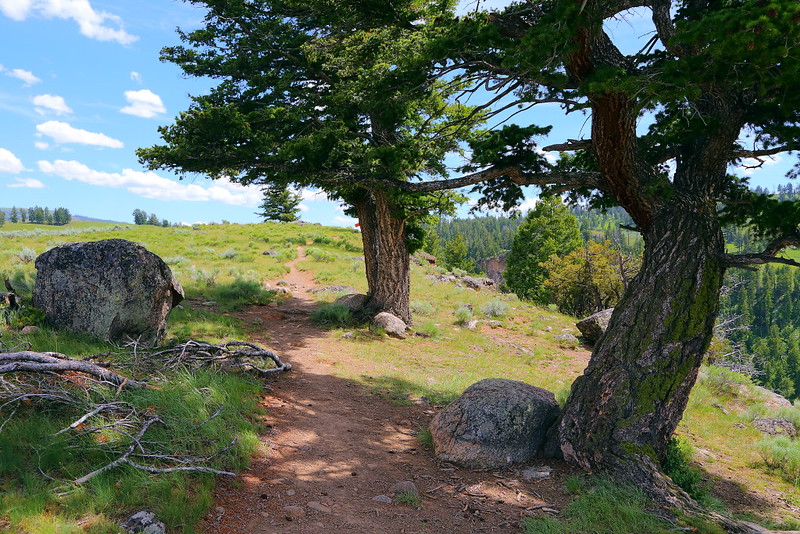
Figure 6-18.3: 步道的一些地方有樹點綴,印象中大部分是Douglas-fir,可以用cone有沒有三叉片來分辨。

Figure 6-18.4: 這區域是黃石大峽谷的最北端,稱為The Narrows。左上方是玄武岩石柱,而河的另一端是馬路,不時可以看到車子穿梭在樹林裡。

Figure 6-18.5: 這地方可以以較近距離看到玄武岩柱。

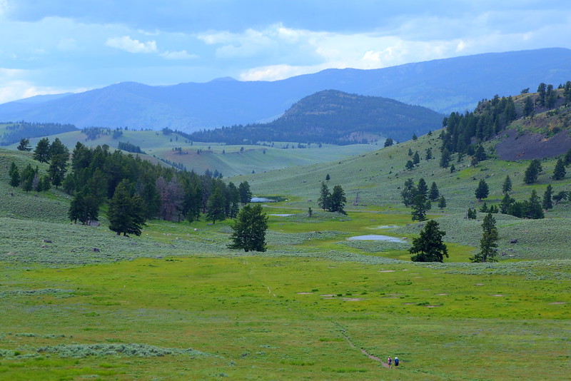
Figure 6-18.6: 藍天、綠地以及三三兩兩的野花,感覺起來像是在郊遊。
這步道的前半段可以居高臨下看到Yellowstone River,而這區域也是黃石大峽谷的最北端,峽谷峭壁直上直下且河道看起來較窄,也許因此得到了The Narrows這個名稱。以這河水的湍急樣,我相信是無法像Zion的The Narrows一樣搞溯溪。
這一段沿著Yellowstone River的步道其實就在公園從Tower Fall到Tower Junction這段路的河對面,因此可以看到類似的玄武岩石柱,只是看的方向不同。如果你曾在開這段路時看到對岸有人走在玄武岩石柱上而好奇這些人是從什麼地方來的,謎底在此揭曉。
我走這步道有另一個目的,就是希望看到bighorn sheep。通常夏天要看到bighorn sheep有幾個地方,一個是Mammoth Hot Springs到North Entrance之間的Gardner River Canyon,另一個是Mount Washburn,而這野餐區或是這步道是另一個機會較好的地方。
我這次走的時候沒有看到bighorn sheep,但隔天在經過這野餐區時倒是有在野餐區的馬路對面看到兩隻母的。所以當你路過這野餐區時不妨稍微左右張望一下,運氣好的話這些羊是可能直接出現在馬路邊或甚至過馬路的。

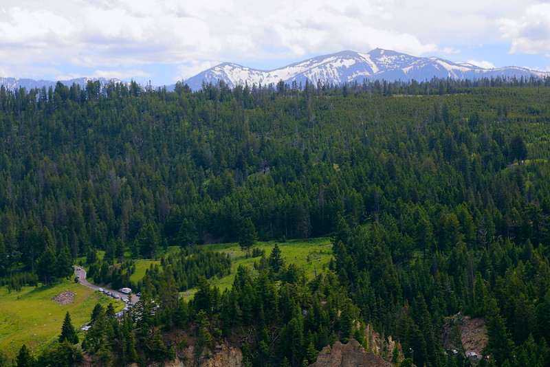
Figure 6-18.7: Yellowstone River對岸的馬路,這座山應該是Mount Washburn,依稀可以看到山上的fire lookout。

Figure 6-18.8: S形的Yellowstone River。

Figure 6-18.9: 繼續一段路後的Yellowstone River,看起來跟上圖差不多。

Figure 6-18.10: 可以考慮走原路回去步道口,不過我是繼續走Specimen Ridge Trail到馬路。

Figure 6-18.11: 剛好在Specimen Ridge Trail上遇到兩個hikers提供比例尺功能。

Figure 6-18.12: 走到Specimen Ridge Trail的步道口後沿著馬路走一段路就會回到Yellowstone Picnic Area這個野餐區。
Figure 6-18.8與Figure 6-18.9大概是步道上最後看到Yellowstone River的地方,可以考慮掉頭往回走,這樣走的話總長可能只有3 miles左右,會比繼續往前走到Specimen Ridge Trail拉一個loop近一點。如果你之前沒看到bighorn sheep,原路往回走也許會增加看到他們的機會。
這段走Specimen Ridge Trail到馬路邊的路是公園北邊典型的桌布類型風景,跟在馬路上看到的調調類似,不走不算可惜,但走了也沒什麼損失,可以視自己到時候的心情決定。不過在我走到接近馬路時,步道的某些地方因融雪而較muddy,但稍微detour一下還不至於弄髒褲腳就是。
一旦走到Specimen Ridge Trail的步道口,沿著馬路邊走個十還是十五分鐘就會回到步道口。
Previous Next
[6-1. Mount Washburn] [6-2. Artists Paintpots] [6-3. Trails at the Grand Canyon of the Yellowstone] [6-4. Natural Bridge] [6-5. Ranger-Led Hike: Lupine Loop Walk] [6-6. Mystic Falls] [6-7. Bunsen Peak] [6-8. Beaver Ponds Loop] [6-9. Lone Star Geyser] [6-10. The Hoodoos] [6-11. Petrified Trees of Specimen Ridge] [6-12. Pelican Creek Nature Trail] [6-13. Cascade Lake] [6-14. Monument Geyser Basin] [6-15. Fairy Falls/Imperial Geyser] [6-16. Elephant Back Mountain] [6-17. Hellroaring Creek] [6-18. Yellowstone River Overlook] [6-19. Trout Lake] [6-20. Riddle Lake] [6-21. Point Sublime] [6-22. Storm Point] [6-23. Lake Overlook] [6-24. Wraith Falls] [6-25. Little Gibbon Falls] [6-26. Osprey Falls] [6-27. Narrow Gauge Terrace] [6-28. Slough Creek] [6-29. Harlequin Lake]
[1. 簡介] [2. 旅遊建議/食宿交通] [3. Sightseeing] [4. Winter Activities] [5. Wildlife Watching] [6. Day Hiking] [7. Other Activities] [8. Who's Who in the Park] [9. More about the Park] [10. 感想]


No comments:
Post a Comment