[1. Introduction] [2. 旅遊建議/食宿交通] [3. Scenic Drive] [4. Day Hiking] [5. Wildlife Watching] [6. Other Activities] [7. Who's Who in the Park] [8. More about the Park] [9. Conclusion]
4. Day Hiking
[4-1. Trail of the Cedars/Avalanche Lake] [4-2. Hidden Lake Trail] [4-3. Ptarmigan Tunnel Trail] [4-4. Grinnell Glacier Viewpoint Trail] [4-5. Iceberg Lake Trail] [4-6. St. Mary/Virginia Falls] [4-7. Highline Trail] [4-8. The Loop Trail] [4-9. Grinnell Lake] [4-10. Apikuni Falls] [4-11. Siyeh Pass/Piegan Pass] [4-12. Aster Park] [4-13. Cobalt Lake] [4-14. Dawson-Pitamakan Loop] [4-15. Upper Two Medicine Lake/Twin Falls] [4-16. Redrock Falls/Bullhead Lake] [4-17. Swiftcurrent Pass Trail] [4-18. Firebrand Pass] [4-19. Comeau Pass/Sperry Glacier] [4-20. Gunsight Pass] [4-21. Triple Divide Pass] [4-22. International Peace Park Hike]
4-12. Aster Park
Distance (Round Trip): 3.8 miles
Trailhead Elevation: 5,188 feet
Highest Elevation: 5,798 feet
Hiking Time: 1.5 to 2.5 hours
公園的Two Medicine這區有幾條短步道,Aster Park是其中之一。步道口在Two Medicine Lake坐船旁邊的South Shore Trailhead,而這步道也可以走到比如Upper Two Medicine Lake或是Cobalt Lake等其他地方。
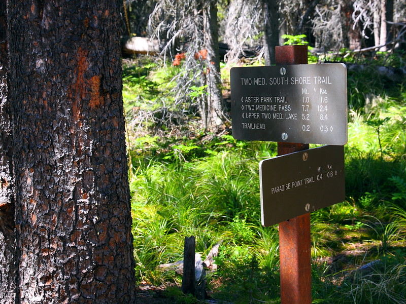
Figure 4-12.1: 這地方已經小走了三分鐘左右,步道口在Two Medicine Lake坐船地方的South Shore Trailhead。
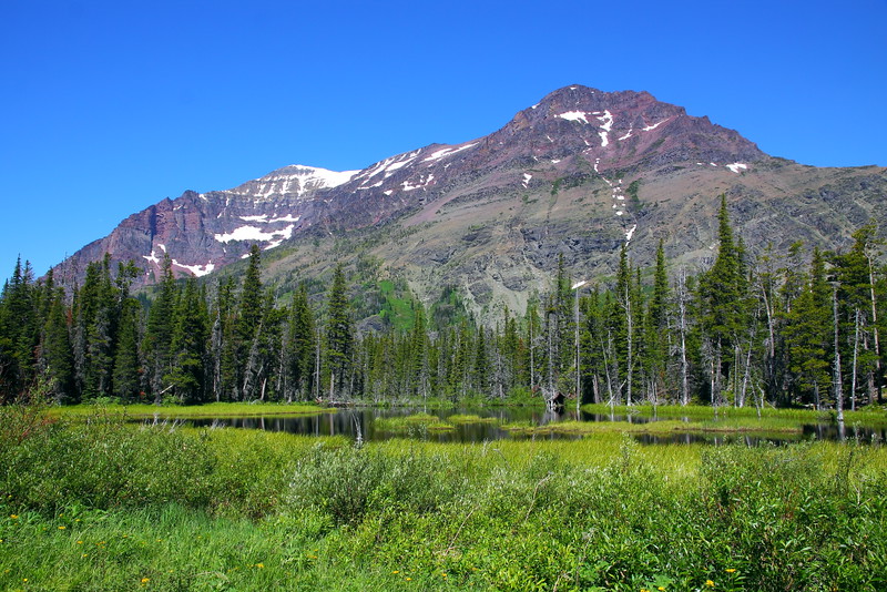
Figure 4-12.2: 時間對的話,這地方可能看到moose,而後面那座大山是Rising Wolf。
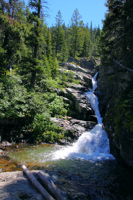
Figure 4-12.3: 走到中途可以看到Aster Falls。
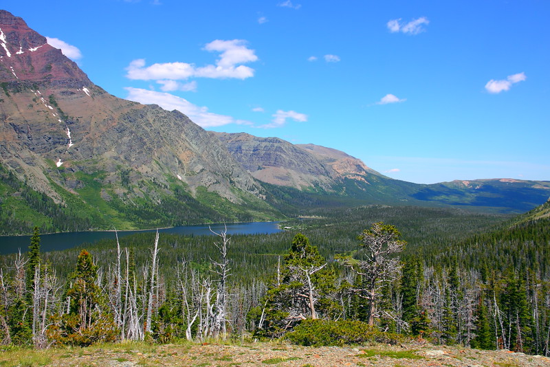
Figure 4-12.4: 這地方就是Aster Park,可以俯視Two Medicine Lake。
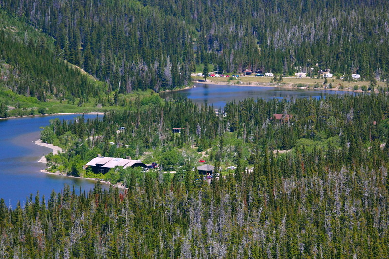
Figure 4-12.5: 拉長鏡頭可以看到湖邊的Two Medicine General Store等設施。

Figure 4-12.6: 另一個角度,最左邊的山是Sinopah Mountain,最右邊的是Rising Wolf,而Rising Wolf旁邊那個山峰應該是Flinsch Peak。
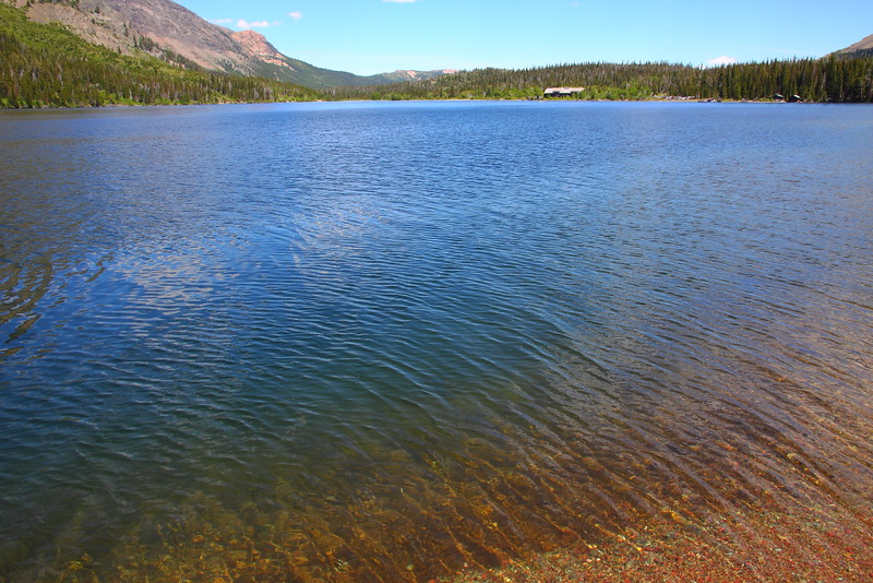
Figure 4-12.7: 這地方是回程時才去的Paradise Point,我是沒有身處Paradise的感覺就是。
Aster Park算是一個眺望點,需要往上爬一小段,但坡度應該還好,途中還會經過Aster Falls。雖然是個眺望點,但大部分的角度都被樹擋住,所以效果不算很理想。雖然如此,走到這的人還不少就是。到達Aster Park之前的湖邊會經過一條通往Paradise Point的短叉路,稍微繞一下不算費力,但也不容易有特別的收穫。
這不是個會讓你印象深刻的步道,不過如果你人剛好就在Two Medicine而且有幾個小時的時間不曉得該做甚麼事,走到Aster Park是個選項。
Previous Next
[4-1. Trail of the Cedars/Avalanche Lake] [4-2. Hidden Lake Trail] [4-3. Ptarmigan Tunnel Trail] [4-4. Grinnell Glacier Viewpoint Trail] [4-5. Iceberg Lake Trail] [4-6. St. Mary/Virginia Falls] [4-7. Highline Trail] [4-8. The Loop Trail] [4-9. Grinnell Lake] [4-10. Apikuni Falls] [4-11. Siyeh Pass/Piegan Pass] [4-12. Aster Park] [4-13. Cobalt Lake] [4-14. Dawson-Pitamakan Loop] [4-15. Upper Two Medicine Lake/Twin Falls] [4-16. Redrock Falls/Bullhead Lake] [4-17. Swiftcurrent Pass Trail] [4-18. Firebrand Pass] [4-19. Comeau Pass/Sperry Glacier] [4-20. Gunsight Pass] [4-21. Triple Divide Pass] [4-22. International Peace Park Hike]
[1. Introduction] [2. 旅遊建議/食宿交通] [3. Scenic Drive] [4. Day Hiking] [5. Wildlife Watching] [6. Other Activities] [7. Who's Who in the Park] [8. More about the Park] [9. Conclusion]


No comments:
Post a Comment