[1. Introduction] [2. 旅遊建議/食宿交通] [3. Scenic Drive] [4. Day Hiking] [5. Wildlife Watching] [6. Other Activities] [7. Who's Who in the Park] [8. More about the Park] [9. Conclusion]
4. Day Hiking
[4-1. Trail of the Cedars/Avalanche Lake] [4-2. Hidden Lake Trail] [4-3. Ptarmigan Tunnel Trail] [4-4. Grinnell Glacier Viewpoint Trail] [4-5. Iceberg Lake Trail] [4-6. St. Mary/Virginia Falls] [4-7. Highline Trail] [4-8. The Loop Trail] [4-9. Grinnell Lake] [4-10. Apikuni Falls] [4-11. Siyeh Pass/Piegan Pass] [4-12. Aster Park] [4-13. Cobalt Lake] [4-14. Dawson-Pitamakan Loop] [4-15. Upper Two Medicine Lake/Twin Falls] [4-16. Redrock Falls/Bullhead Lake] [4-17. Swiftcurrent Pass Trail] [4-18. Firebrand Pass] [4-19. Comeau Pass/Sperry Glacier] [4-20. Gunsight Pass] [4-21. Triple Divide Pass] [4-22. International Peace Park Hike]
4-15. Upper Two Medicine Lake/Twin Falls
Distance (Round Trip): 4.4 miles by boat, 10.8 miles from South Shore Trailhead
Trailhead Elevation: 5,188 feet
Highest Elevation: 5,505 feet
Hiking Time: 1.5 to 2.5 hours by boat, 4.5 to 6 hours from South Shore Trailhead
Upper Two Medicine Lake是Two Medicine這區的一個family-friendly中短程步道,角色有點類似Many Glacier那區的老少咸宜步道Grinnell Lake。一般是建議坐船到Two Medicine Lake的對岸走這步道,這樣子來回只需要走4 miles多一點,而且中間還可以看一下Twin Falls這個小風景,雖然Upper Two Medicine Lake用這公園的標準來說也不算大風景就是。
此外,船公司也有提供類似先坐船之後hiking到Grinnell Lake的活動,不過這邊只走到Twin Falls就是。
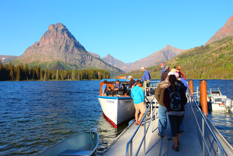
Figure 4-15.1: 正在搭第一班九點的船班,船的名子叫Sinopah,也就是左邊這山的名子。最右邊是Rising Wolf的底部,之後左邊這個山峰是Mount Helen,而Mount Helen與Sinapoh Mountain中間的那個山峰是Lone Walker Mountain,Lone Walker與Sinopah中間那一小部分是Mount Rockwell。
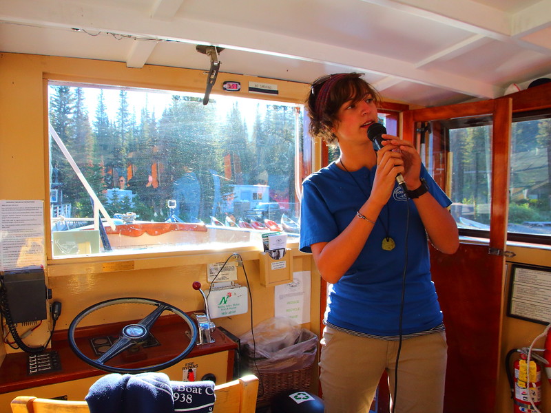
Figure 4-15.2: 正妹船長在船上的講解。
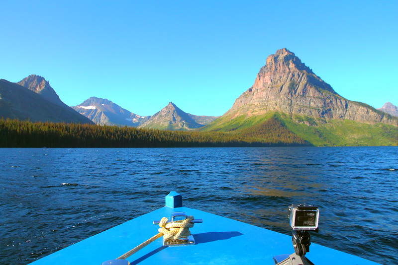
Figure 4-15.3: 駛向Two Medicine Lake的對岸,順便複習一下山峰。最右邊那個小山峰是Lone Walker,Sinopah左邊第一個小山峰是Painted Teepe Peak,第二個是Never Laughs Mountain,第三個是Mount Ellsworth,而Mount Ellsworth前方的那個斜坡應該是Mount Henry的底部。
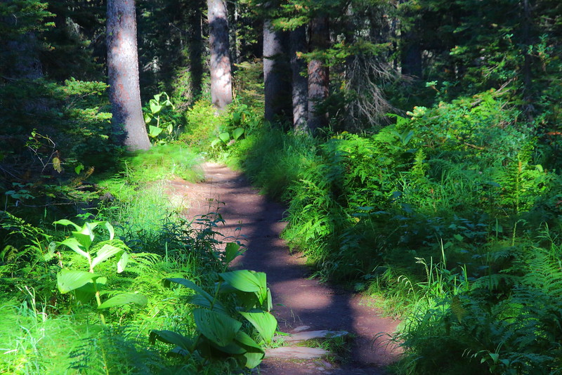
Figure 4-15.4: 下船後的步道基調是樹林與草叢。
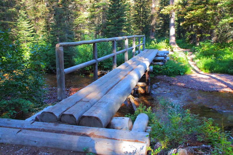
Figure 4-15.5: 公園步道上有不少這種造型的橋。
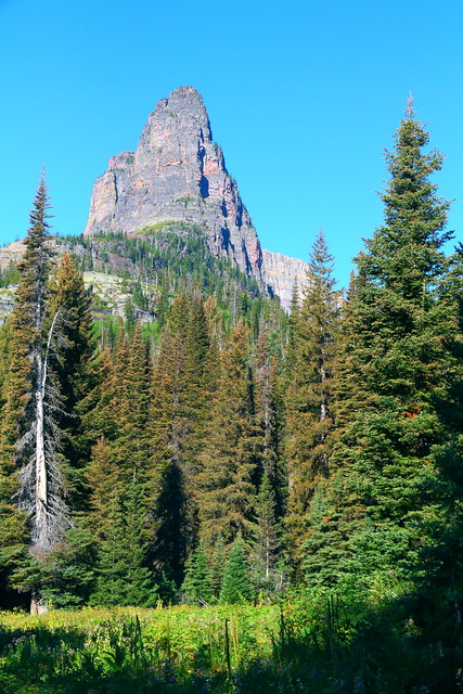
Figure 4-15.6: 這根是Pumpelly Pillar,是個arête,雖然從這角度看不像就是。
我第一次想來這是個下午,因為飛機大概在中午抵達Kalispell且夜宿Glacier Park Lodge,想說下午剩下的時間就到這鬼混好了。不幸的是船票已經賣完,所以那次就沒有成行。
公園可以看大景的步道大都有個同樣的特徵,就是得花力氣爬一段高度,除非你的起點是在Logan Pass這已經夠高的地方。Upper Two Medicine Lake這步道沒什麼大爬坡而處在低海拔的地方,走起來不費什麼力氣。終點的湖邊有山當backdrop,只要沒有不切實際的過高期待,景色其實還ok,......但有個有趣之處。這湖被幾座山所包圍,比如最醒目的Mount Rockwell、Lone Walker Mountain以及右側的Mount Helen,湖邊這幾座山山頂所連成的虛擬線就是Continental Divide。
若要走這步道,用郊遊踏青的心情會比較恰當,天氣配合的話整趟走下來也算是輕鬆愉快。如果想要在步道上解決中餐,Twin Falls或是Upper Two Medicine Lake的湖邊都算是不錯的地點。
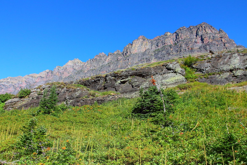
Figure 4-15.7: 繼續走可以看到Pumpelly Pillar的另一面,這就看得出是個arête了。
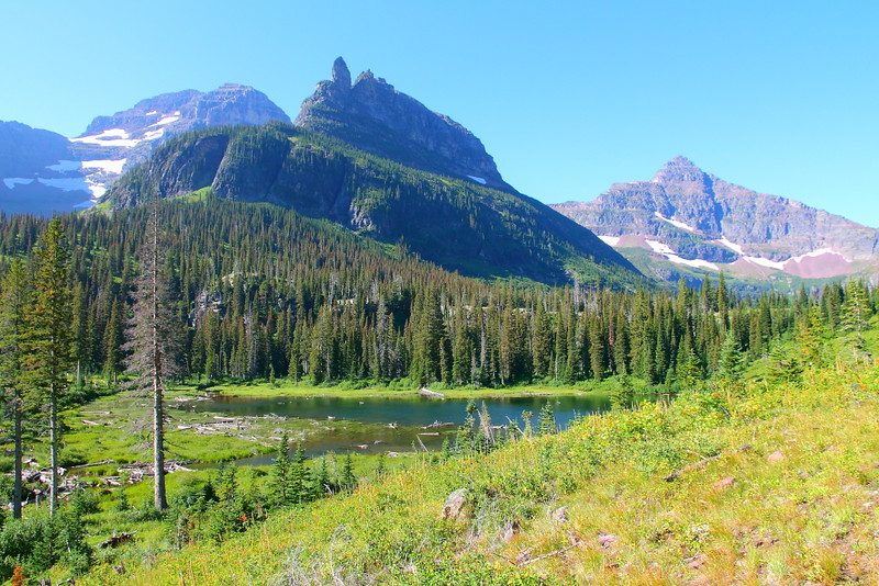
Figure 4-15.8: 走到這離終點已經不遠,視野變得較開闊。正前方最近的這個山是Mount Rockwell,右邊的是Lone Walker Mountain,而左邊被Mount Rockwell擋在後面的是Sinopah Mountain。
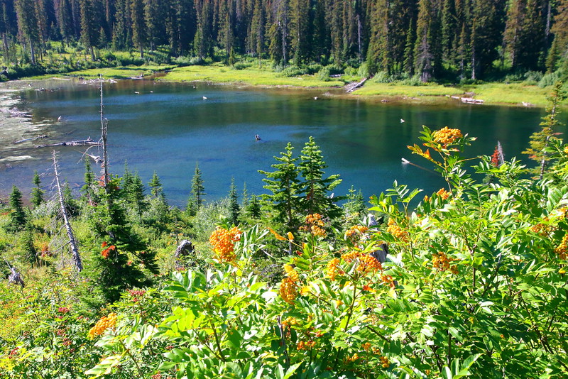
Figure 4-15.9: 上圖的小水池。
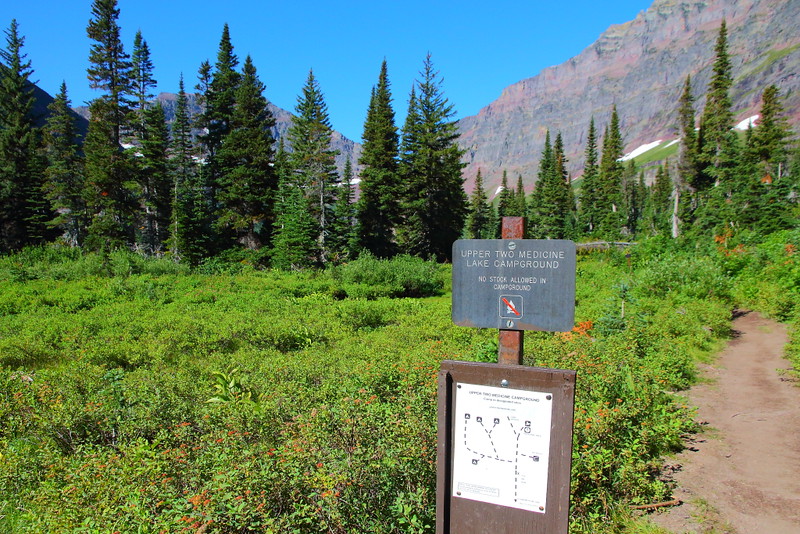
Figure 4-15.10: Upper Two Medicine Lake旁有backcountry campground。
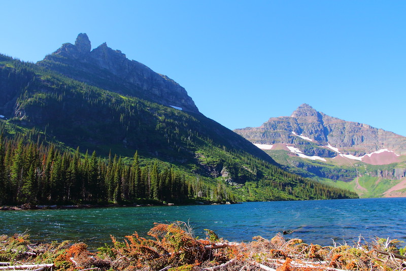
Figure 4-15.11: 抵達Upper Two Medicine Lake的湖岸。左邊這山是Mount Rockwell,而右邊較矮的山峰是Lone Walker Mountain。
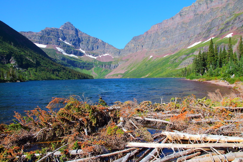
Figure 4-15.12: 換個角度,看起來也是差不多。右邊這個斜坡是Mount Helen的底部。
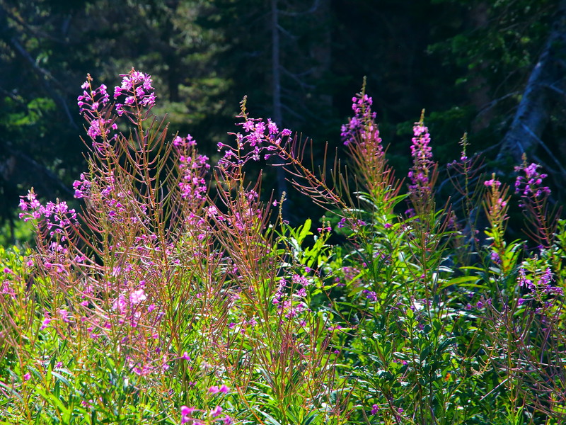
Figure 4-15.13: 步道旁有不少粉紅色的fireweed。
雖然沒走去Upper Two Medicine Lake不算是甚麼損失,2014年時終於找到了個perfect的機會到這。這年請了Labor Day前一周的假與朋友到這,總共有九個整天的時間在公園,反正之前都到過這公園且路上該看的也都看過了,於是進行走100 miles做業績的活動。
在走這步道前一天參加了Ranger-Led Firebrand Pass Hike,之前兩天分別又走了Cracker Lake與Otokomi Lake,三天下來已經連走了超過30 miles,而隔天又要走Gunsight Pass到Sperry Chalet並在過夜後走去看Sperry Glacier,在這前後都得各走約30 miles的中間剛好可以安插個休息日。為了怕一天不走會對之後造成業績壓力,而前一晚又剛好住在Glacier Park Lodge,於是Upper Two Medicine Lake這不傷腿的hiking成為了最好的體力調節步道。
走完Upper Two Medicine Lake後原本是要搭船回去,但因為還要等一小時,乾脆自己走回去比較快。湖的南岸與北岸都有步道可以走回去,搭船的碼頭離South Shore Trail比較近,所以就走這步道回去,意外發現這步道在剛離開碼頭的這段約0.5 mile的路還蠻漂亮的,差不多是Figure 4-15.16到Figure 4-15.18之間的路段,代價是需要往上爬一小段,但坡度不算太陡就是。
因為這晚住在Lake McDonald Lodge的motel房間,離開Two Medicine後在到達Logan Pass時剛好可以順便走一下Hidden Lake(mountain goats果然如我所料被裝上了radio collar)湊到11 miles,差不多是九天走100 miles的平均值。
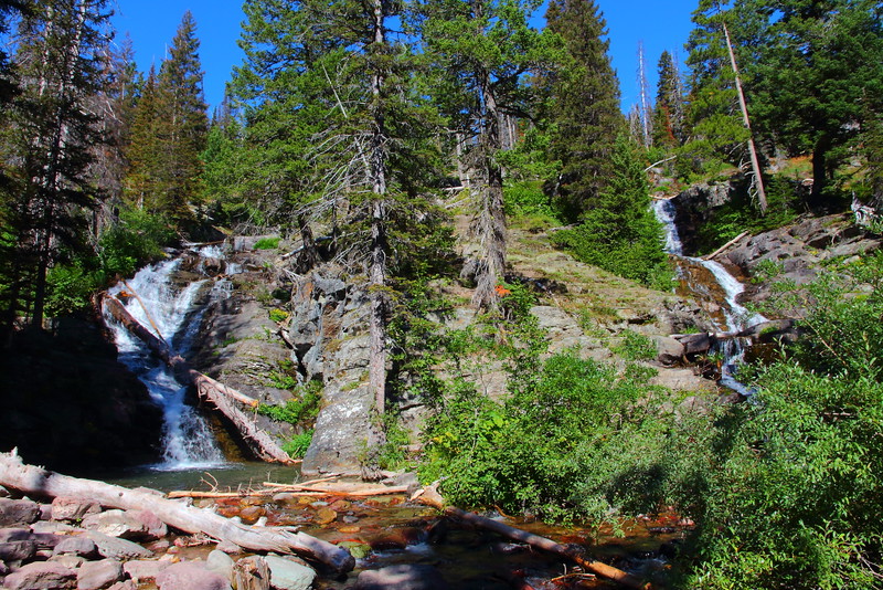
Figure 4-15.14: 既然叫Twin Falls,當然得看到兩個瀑布。
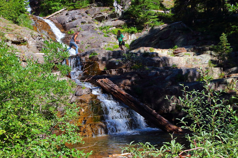
Figure 4-15.15: 不少人喜歡在瀑布上下嬉戲。
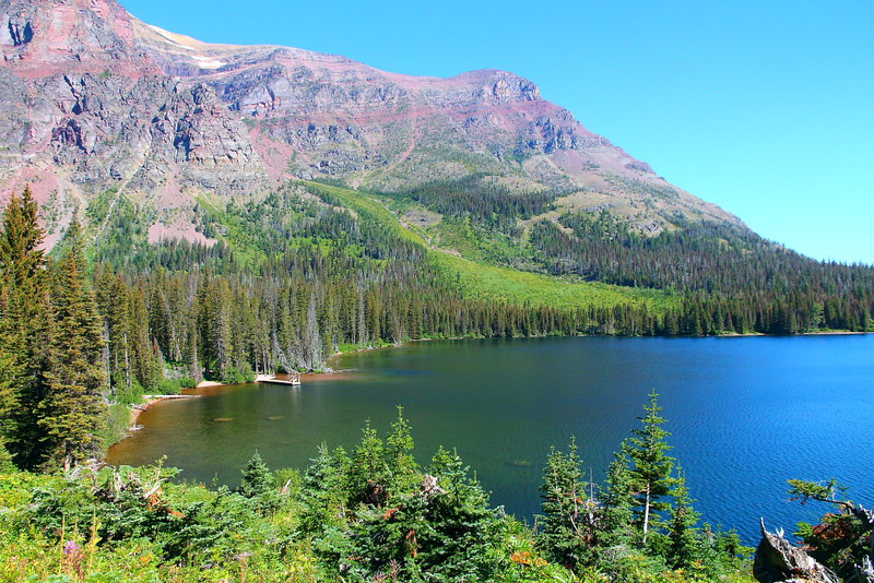
Figure 4-15.16: 剛離開碼頭不久的South Shore Trail,湖後方的大山是Two Medicine這區最常見幾座山之一的Rising Wolf Mountain。
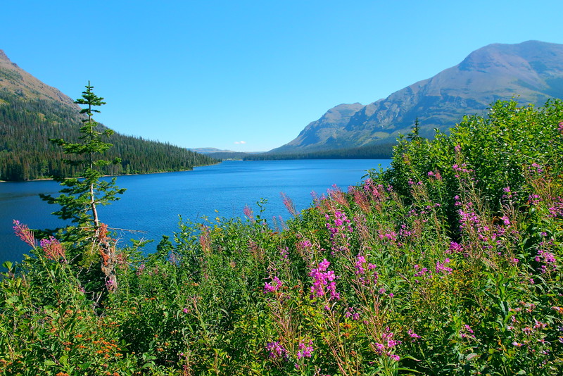
Figure 4-15.17: 有望遠鏡的話,可以看到對岸的Two Medicine General Store。
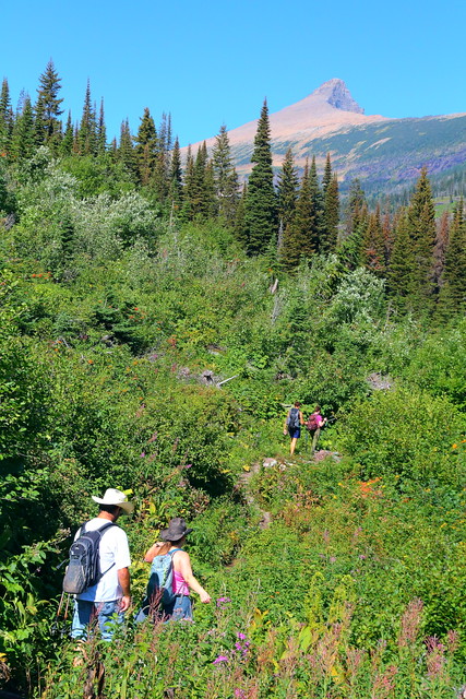
Figure 4-15.18: 一群反向走過來的hikers,上方的山峰是Flinsch Peak。
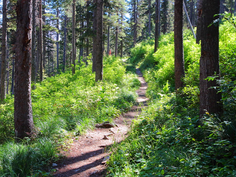
Figure 4-15.19: South Shore Trail並不完全平,中間有個地方得稍微往上爬一下。
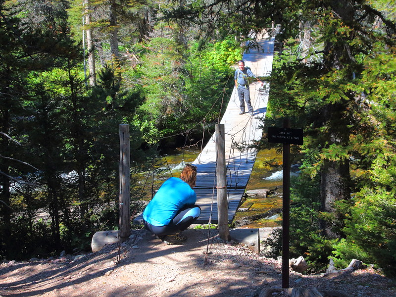
Figure 4-15.20: 經驗上,很多人喜歡在這個離步道口不遠的吊橋照相,去Aster Park或是Cobalt Lake的途中都會經過這地方。
每條步道都有自己的屬性,條件正確下也是可以走出最大效果的。
Previous Next
[4-1. Trail of the Cedars/Avalanche Lake] [4-2. Hidden Lake Trail] [4-3. Ptarmigan Tunnel Trail] [4-4. Grinnell Glacier Viewpoint Trail] [4-5. Iceberg Lake Trail] [4-6. St. Mary/Virginia Falls] [4-7. Highline Trail] [4-8. The Loop Trail] [4-9. Grinnell Lake] [4-10. Apikuni Falls] [4-11. Siyeh Pass/Piegan Pass] [4-12. Aster Park] [4-13. Cobalt Lake] [4-14. Dawson-Pitamakan Loop] [4-15. Upper Two Medicine Lake/Twin Falls] [4-16. Redrock Falls/Bullhead Lake] [4-17. Swiftcurrent Pass Trail] [4-18. Firebrand Pass] [4-19. Comeau Pass/Sperry Glacier] [4-20. Gunsight Pass] [4-21. Triple Divide Pass] [4-22. International Peace Park Hike]
[1. Introduction] [2. 旅遊建議/食宿交通] [3. Scenic Drive] [4. Day Hiking] [5. Wildlife Watching] [6. Other Activities] [7. Who's Who in the Park] [8. More about the Park] [9. Conclusion]


No comments:
Post a Comment