[1. Introduction] [2. 旅遊建議/食宿交通] [3. Scenic Drive] [4. Day Hiking] [5. Wildlife Watching] [6. Other Activities] [7. Who's Who in the Park] [8. More about the Park] [9. Conclusion]
4. Day Hiking
[4-1. Trail of the Cedars/Avalanche Lake] [4-2. Hidden Lake Trail] [4-3. Ptarmigan Tunnel Trail] [4-4. Grinnell Glacier Viewpoint Trail] [4-5. Iceberg Lake Trail] [4-6. St. Mary/Virginia Falls] [4-7. Highline Trail] [4-8. The Loop Trail] [4-9. Grinnell Lake] [4-10. Apikuni Falls] [4-11. Siyeh Pass/Piegan Pass] [4-12. Aster Park] [4-13. Cobalt Lake] [4-14. Dawson-Pitamakan Loop] [4-15. Upper Two Medicine Lake/Twin Falls] [4-16. Redrock Falls/Bullhead Lake] [4-17. Swiftcurrent Pass Trail] [4-18. Firebrand Pass] [4-19. Comeau Pass/Sperry Glacier] [4-20. Gunsight Pass] [4-21. Triple Divide Pass] [4-22. International Peace Park Hike]
4-8. The Loop Trail
Distance (one way): 4.0 miles
The Loop Elevation: 4,397 feet
Granite Park Chalet Elevation: 6,650 feet
Hiking Time: 1.5 - 2.5 hours
因為步道口就在Going-to-the-Sun Road的The Loop這一站,所以這步道被稱為Loop Trail,並不是因為這步道自己是一個loop,且這步道的終點是Granite Park Chalet。因為這是走到Granite Park (Chalet)最近的步道,有時候也被稱為是Granite Park Trail,聽起來比Loop Trail有吸引力不少。
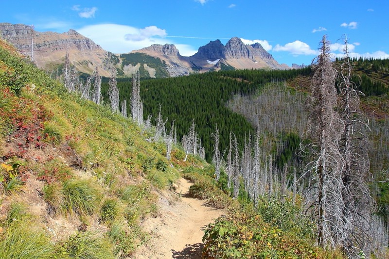
Figure 4-8.1: Loop Trail是個可以看被大火燒過森林的步道。
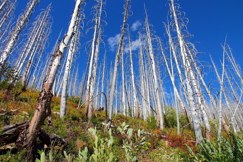
Figure 4-8.2: 雖然被火燒死了,但因為這邊比較冷分解速度慢,所以形成了所謂的standing dead,跟Yellowstone那一堆死了還不倒的lodgepole pine類似。
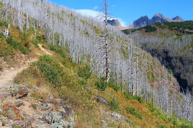
Figure 4-8.3: 這邊又是一片被燒死的樹。
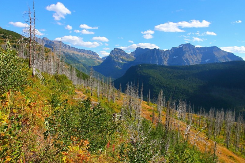
Figure 4-8.4: 步道有些地方有開闊的視野,這角度跟從Going-to-the-Sun Road看類似,但前景不一樣。
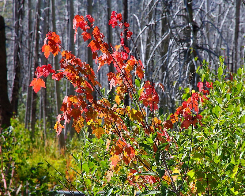
Figure 4-8.5: 這看起來像是Rocky Mountain maple,九月初就變色了。
Loop Trail主要景觀是被2003的一場叫做Trapper Creek Fire燒過的森林,因為這邊比較冷分解較慢,所以即使被火燒死那麼久了還是不倒下,形成了所謂的standing dead。雖然如此,步道上的綠意依然很高,春天還會開花,不完全是ghost forest的感覺,尤其如果你是在天氣好的時候走的話。這步道也有一些眺望遠方的角度,不過不算很特別就是。
因為不是大部分人的首要選擇,這步道上的人通常不多,跟Highline Trail搭配成為一個long day hike是比較多人的選擇,而且從Granite Park Chalet往Going-to-the-Sun Road幾乎是全程下坡,只在快到達馬路的步道口前有一小段的簡單爬坡得走,通常不需要二小時就可以完成。
當然,你也可以從Going-to-the-Sun Road的步道口走,並以Granite Park Chalet為目標,就變成了一個來回8 miles的day hiking。除了參觀一下這個傳說中的山中小屋外,也可以欣賞一下Granite Park這區域的風景。當然,行有餘力的話也可以走上Glacier Overlook這個Highline Trail的支線。
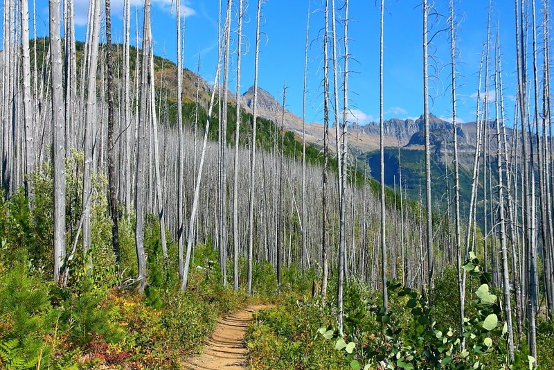
Figure 4-8.6: 雖然整路大都是死掉的樹木,地上大部分的地方是綠意盎然,表示森林野火確實並沒有摧毀森林。
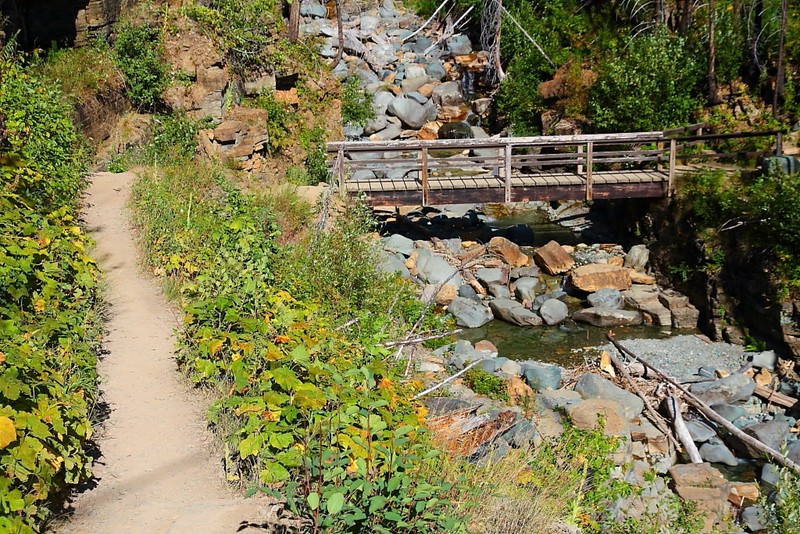
Figure 4-8.7: 看到這座橋的意思就是快到Going-to-the-Sun Road了。
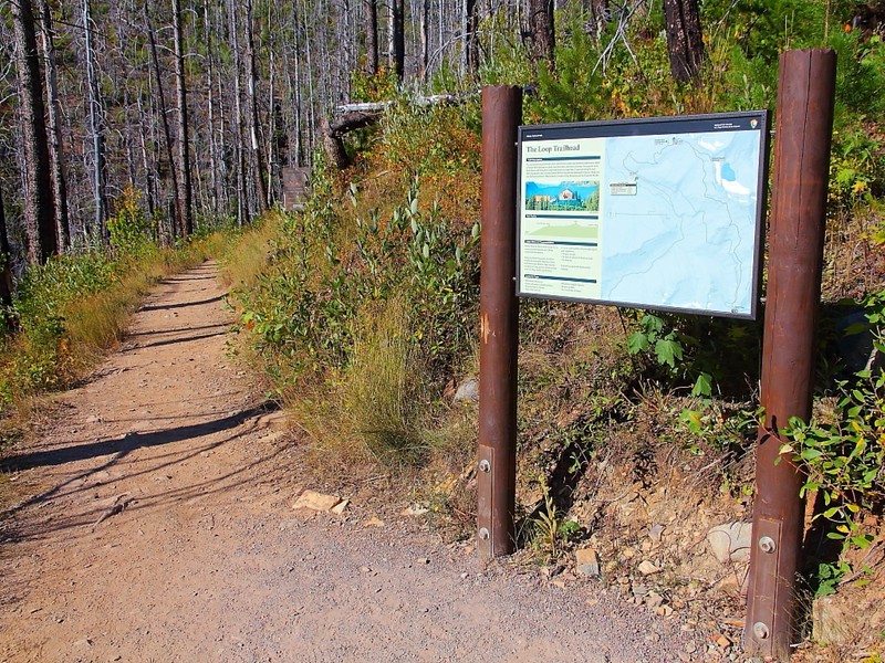
Figure 4-8.8: 這應該才算是這步道的步道口。
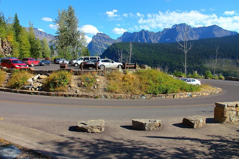
Figure 4-8.9: The Loop的停車場。

Figure 4-8.10: 往Logan Pass這方向還蠻熱門的,運氣不好的話車上沒剩幾個座位,排隊排太後面得等另一斑車。
這步道我走過二次,都是由Granite Park Chalet往下走到Going-to-the-Sun Road。第一次走是在Granite Park Chalet住過一晚後,隔天因為天氣不好,所以放棄了走Swiftcurrent Pass Trail到Many Glacier的原訂計畫,以這步道快速撤退,而途中在步道上還看到新鮮的熊糞便,但分不清楚是grizzly bear還是black bear的就是;第二次則是走Highline Trail與Glacier Overlook後直接以這步道回到Going-to-the-Sun Road。因為要趕坐回到Logan Pass的公車,不少路段是以連走帶跑在進行,所以之前在Highline Trail那段提到若要走Glacier Overlook的話得控制好時間,以免趕不上回到Logan Pass公車。
若真錯過了最後一班公車,帶Highline trail的Ranger阿嫚達有句名言,"There is always hitchhike.",雖然最好是不要用到這個Plan B就是。
Previous Next
[4-1. Trail of the Cedars/Avalanche Lake] [4-2. Hidden Lake Trail] [4-3. Ptarmigan Tunnel Trail] [4-4. Grinnell Glacier Viewpoint Trail] [4-5. Iceberg Lake Trail] [4-6. St. Mary/Virginia Falls] [4-7. Highline Trail] [4-8. The Loop Trail] [4-9. Grinnell Lake] [4-10. Apikuni Falls] [4-11. Siyeh Pass/Piegan Pass] [4-12. Aster Park] [4-13. Cobalt Lake] [4-14. Dawson-Pitamakan Loop] [4-15. Upper Two Medicine Lake/Twin Falls] [4-16. Redrock Falls/Bullhead Lake] [4-17. Swiftcurrent Pass Trail] [4-18. Firebrand Pass] [4-19. Comeau Pass/Sperry Glacier] [4-20. Gunsight Pass] [4-21. Triple Divide Pass] [4-22. International Peace Park Hike]
[1. Introduction] [2. 旅遊建議/食宿交通] [3. Scenic Drive] [4. Day Hiking] [5. Wildlife Watching] [6. Other Activities] [7. Who's Who in the Park] [8. More about the Park] [9. Conclusion]


No comments:
Post a Comment