[1. 簡介] [2. 旅遊建議/食宿交通] [3. Scenic Drive] [4. Day Hiking] [5. Wildlife Watching] [6. Other Activities] [7. More about Zion] [8. Conclusion]
4. Day Hiking
[4-1. Watchman Trail] [4-2. Pa'rus Trail] [4-3. Emerald Pools] [4-4. Riverside Walk] [4-5. Angels Landing] [4-6. Observation Point] [4-7. Hidden Canyon] [4-8. The Narrows] [4-9. Canyon Overlook] [4-10. Taylor Creek] [4-11. Timber Creek Overlook] [4-12. Kolob Arch/La Verkin Creek Trail] [4-13. Observation Point and Condor 299] [4-14. Northgate Peaks] [4-15. Chinle (Petrified Forest) Trail] [4-16. Sand Bench Trail] [4-17. West Rim Trail] [4-18. Deertrap Mountain] [4-19. The Subway]
4-16. Sand Bench Trail
Distance (round trip): 3.5 miles
Trailhead Elevation: 4,400 feet
Elevation Gain: 200 feet
Hiking Time: ~2 hours
在之前公園夏天的報紙裡,Sand Bench Trail是個刻意被忽略的步道,一個原因是這是公園裡主要的騎馬步道,所以都只在冬天的報紙裡提到。近年來這公園的遊客大增,不但年訪客量超過四百萬,2017年更超過Yosemite與Rocky Mountain成為年訪客量僅次於Great Smokey Mountains與Grand Canyon的國家公園,可說是相當驚人,這個算小的國家公園儼然成為了National Park System裡的小巨人。
也許是為了疏散其他熱門步道上的人潮,這步道現在也列在公園夏天的報紙裡。目前走這步道的人還很少,幾年後會發生甚麼事就難說了。
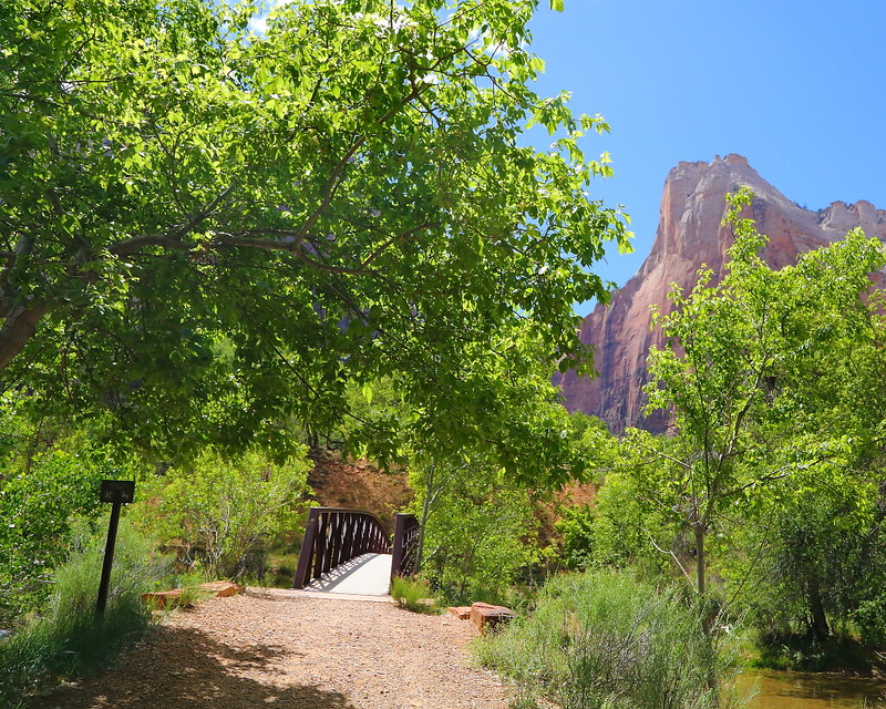
Figure 4-16.1: 從Court of the Patriarchs往Virgin River走一小段路後會看到這個有Sand Bench Trail的步道告示。
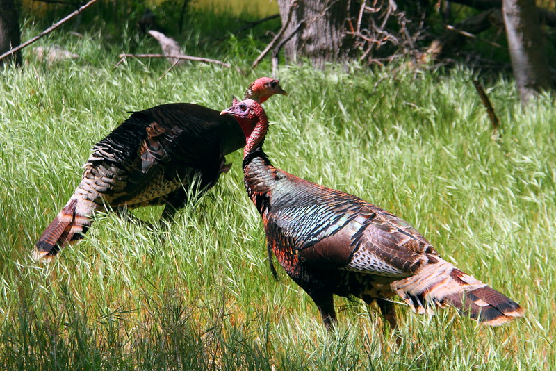
Figure 4-16.2: 幾隻在步道旁的火雞。
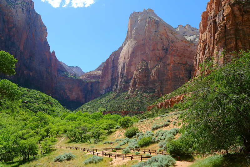
Figure 4-16.3: 這地方是騎馬的人一個回頭的地方。
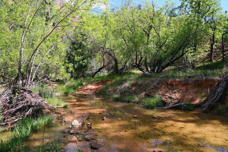
Figure 4-16.4: 需要跨過Birch Creek到另一岸。
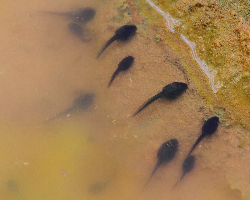
Figure 4-16.5: 溪水裡的蝌蚪。
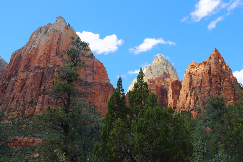
Figure 4-16.6: 這邊已經開始走在Sand Bench Trail的上坡路段,從左手邊的山峰分別是Issac、Jacob與Mount Moroni。
2018年公園報紙給的Sand Bench Trail資訊是從Zion Lodge開始走,距離會比較長。比較近的走法是從Court of the Patriarchs的公車站開始走,這樣整趟只要3.5 miles,在大太陽下會容易很多。
在有限的時間以及不少其他的選擇下,Sand Bench Trail很難在旅遊旺季得到遊客觀愛的眼神,長久以來一直不是Zion Canyon裡檯面上的步道。這步道我走過幾次,還包括騎馬,路程不算長且爬坡也不算大,沿路的風景其實不錯,整體來說是條投資報酬率相當不錯的步道。
步道最難走的路段是進入loop後走在沙子上的爬坡路段,也是這步道被稱為sand bench的原因,不少地方得直接走在沙子上。雖然說全部的爬坡距離不算特別長,但因為腳會陷在裡面,走起來會比較吃力,尤其是大太陽的時候。我分別用過順時鐘與逆時鐘的方向走這段loop,並不覺得用那個方向走會比較省力。
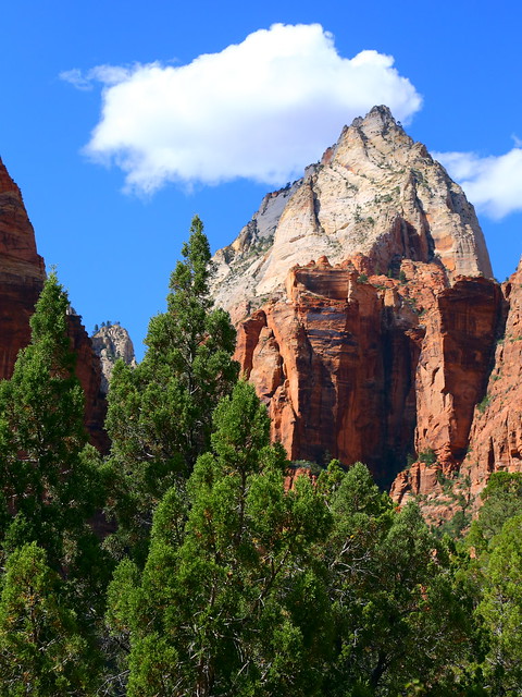
Figure 4-16.7: Jacob常常被Mount Moroni擋住,難得有自己的獨照。
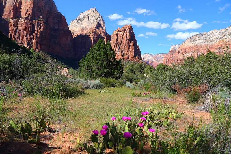
Figure 4-16.8: 走到更高一點的地方,視野更加開闊。
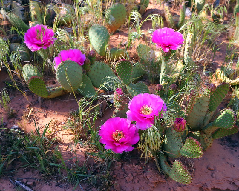
Figure 4-16.9: 這是beavertail cactus的花。
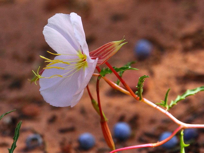
Figure 4-16.10: 第一次見到pale evening primrose (Oenothera pallida)這花,地上藍藍的東西是Utah juniper的berry。
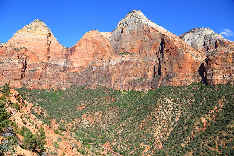
Figure 4-16.11: 這角度可以看到Mountain of the Sun、Twin Brothers與East Temple,下方剛好有一輛公園的shuttle bus經過。
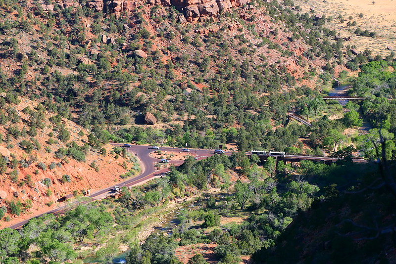
Figure 4-16.12: 俯視Canyon Junction。
我自己比較喜歡在下午的時間走,也就是這次走的時間。除了The Streaked Wall與The Sentinel會逆光外,另一個方向的Mountain of the Sun、Twin Brothers與East Temple會是順光,更遠一點的Bridge Mountain與The Watchman在這時間看起來可能也會比早上好一點。
下午走一般會比較曬,不過我那天下午三點半左右走的時候大概只有high 70s,而且我刻意走很慢,沒有預期中的辛苦。如果你選擇在五點之後的時間走,逆時針方向走這步道的loop有機會全部都走在陰影裡,因為太陽大概在六點前會被The Streaked Wall與The Sentinel擋住而曬不到步道,會容易且舒服很多。
慢慢走的一個目的是找野花,順便混時間降低太陽的殺傷力。因為已經是五月中,加上去年冬天很乾沒下太多的雪或雨,我一開始並沒有很高的期待,只要還能看就可以。整趟走下來比預期好很多,看到pale evening primrose (Oenothera pallida)這花可說是最大的收獲,雖然這不算是難看到的野花。這花主要是開晚上,所以花名有evening,但午後就可能開花而未必得到傍晚,之後一直開花到隔天早上陽光太強才會枯萎。
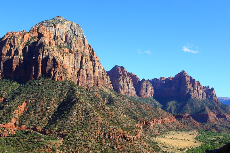
Figure 4-16.13: 左手邊的Bridge Mountain與右手邊的The Watchman。
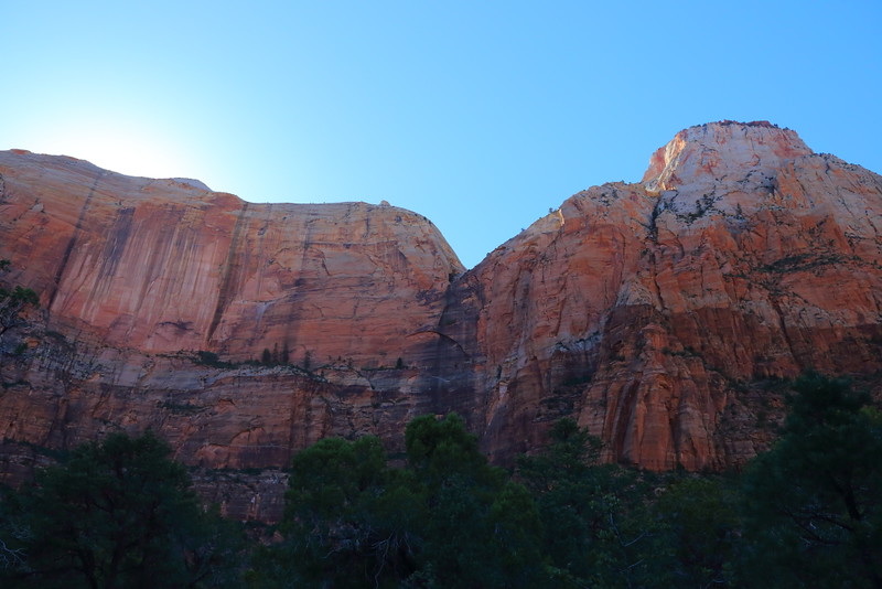
Figure 4-16.14: The Streaked Wall與The Sentinel。
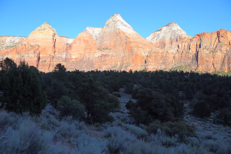
Figure 4-16.15: 因為太陽已經被峽谷的高牆擋住,從現在開始完全走在陰影下。
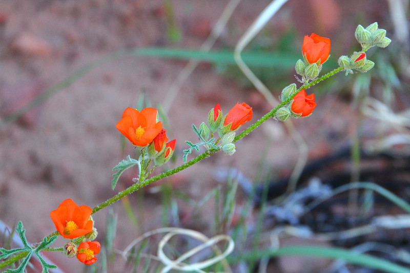
Figure 4-16.16: 另一種野花gooseberry-leaved globemallow,雖然公園其他種類的globemallow長得也差不多是這樣子。
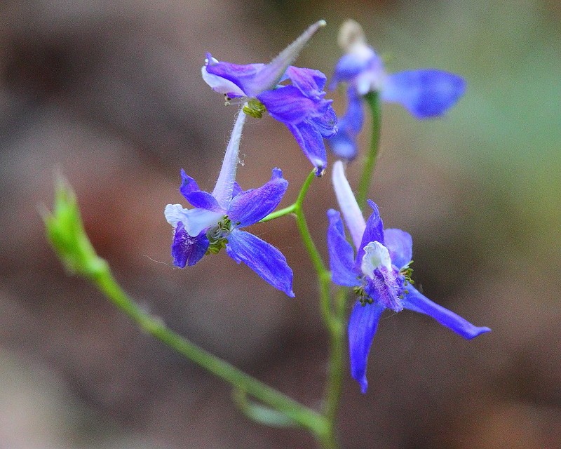
Figure 4-16.17: 這個是larkspur。
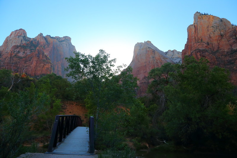
Figure 4-16.18: 回到Virgin River的橋,之後再走幾步就回到馬路上的bus stop。
走這步道另一個也許可以算是吸引力的地方,就是可以比較清楚看到Jacob這個三長老之一的山峰。Jacob是Three Patriarchs之一,從馬路上大都會被Mount Moroni擋住,這步道提供欣賞Jacob最好的角度。不過到這公園的遊客大概只認Angels Landing,其他山峰叫甚麼名子通常不會太有興趣就是。
Zion大概從三月底還是四月初左右就開始人潮洶湧,而且是一直湧到步道上。如果你想要在旅遊旺季有獨自享受Zion Canyon的solitude感覺,這步道是最好的機會,相當清靜。如果對野花有興趣,四月可能是最理想的月份。
Previous Next
[4-1. Watchman Trail] [4-2. Pa'rus Trail] [4-3. Emerald Pools] [4-4. Riverside Walk] [4-5. Angels Landing] [4-6. Observation Point] [4-7. Hidden Canyon] [4-8. The Narrows] [4-9. Canyon Overlook] [4-10. Taylor Creek] [4-11. Timber Creek Overlook] [4-12. Kolob Arch/La Verkin Creek Trail] [4-13. Observation Point and Condor 299] [4-14. Northgate Peaks] [4-15. Chinle (Petrified Forest) Trail] [4-16. Sand Bench Trail] [4-17. West Rim Trail] [4-18. Deertrap Mountain] [4-19. The Subway]
[1. 簡介] [2. 旅遊建議/食宿交通] [3. Scenic Drive] [4. Day Hiking] [5. Wildlife Watching] [6. Other Activities] [7. More about Zion] [8. Conclusion]


No comments:
Post a Comment