[1. Introduction] [2. Sightseeing] [3. Hiking] [4. Winter Activity]
3. Hiking
[3-1. Cottonwood Lakes/Muir Lake] [3-2. New Army Pass] [3-3. South Fork Lakes/Cirque Lake] [3-4. Chicken Spring Lake/Cottonwood Pass] [3-5. Kearsarge Pass/Kearsarge Lakes] [3-6. Big Pine Lakes] [3-7. Little Lakes Valley/Morgan Pass] [3-8. Lamarck Lakes] [3-9. Bishop Pass] [3-10. Treasure Lakes] [3-11. Chocolate Lakes Loop] [3-12. Sabrina Basin/Hungry Packer Lake]
3-4. Chicken Spring Lake/Cottonwood Pass
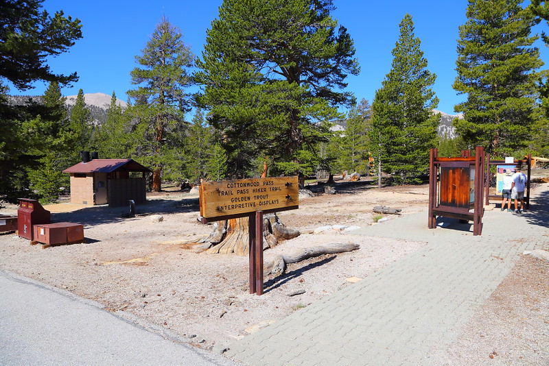
Figure 3-4.1: Cottonwood Pass的步道口。

Figure 3-4.2: 走一小段後進入Inyo National Forest所管理的Golden Trout Wilderness。

Figure 3-4.3: 步道前段看到的大都是lodgepole pine。
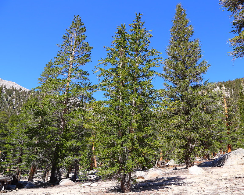
Figure 3-4.4: 中間這連體嬰的樹看起來顯然跟旁邊那兩棵的葉形不同,是foxtail pine,旁邊那兩棵是lodgepole pine。

Figure 3-4.5: 葉形很像狐狸的尾巴,所以被稱為foxtail pine,尖端則是這樹的松果。
離Cottonwood Lakes步道口不遠的地方有一個可以通往Cottonwood Pass與其他地方的步道,從Lone Pine這小鎮要開車的路幾乎一樣,都是開在Horseshoe Meadow Road上,最後右轉會到Cottonwood Lakes的步道口,直走則是到Cottonwood Pass的步道口。
雖然pass這種地方常常都有很大的可看性,不過Cottonwood Pass這地方看到的是個大meadow,驚艷程度並不算高,好在不遠處有個Chicken Spring Lake這比較適合當終點的地方,也因此大部分的day hiker都會多走這一小段路到這湖,視自己的心情決定要在這待多久,之後走回步道口;這湖也同時是backpacker紮營過夜的好地方,我兩次到這都有在湖邊看到幾個帳篷。
原路來回Chicken Spring Lake大概是8.5 miles這距離,從約10,000 feet高的步道口爬升約1,400 feet到達這湖,用Eastern Sierra的標準來說算是容易,但如果你剛從平地上來依然會感到因為高度所帶來的難度,也可能會有頭痛之類的高山症。即使如此,對平常就有在爬山的人來說問題應該不大。
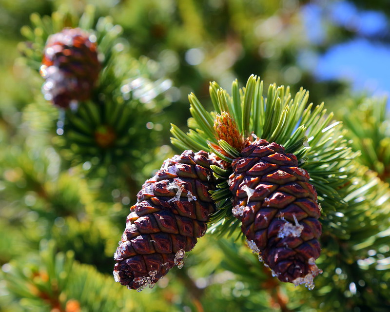
Figure 3-4.6: 狐尾松seed cone的特寫。
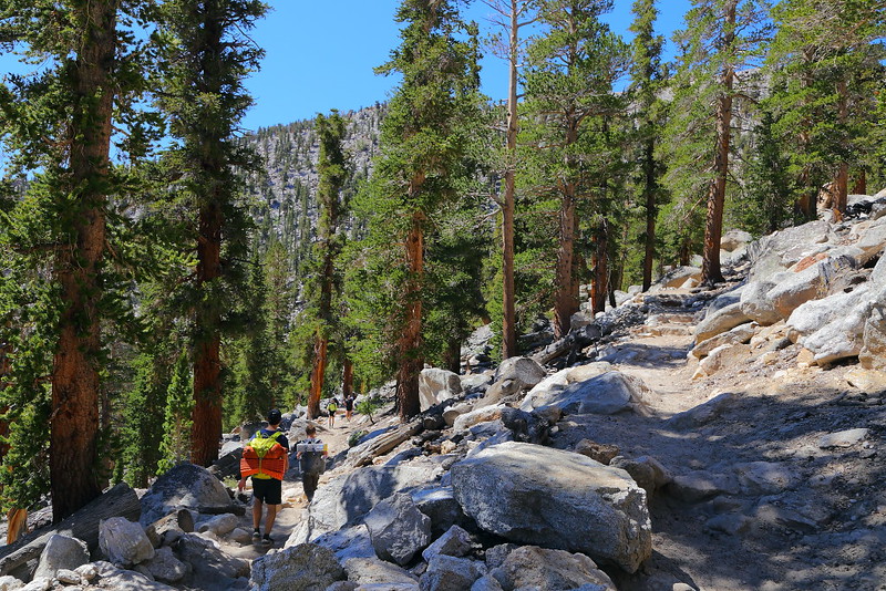
Figure 3-4.7: 這邊開始switchbacks上坡。

Figure 3-4.8: 我被這一對體力很好的backpackers超車,這地方離Cottonwood Pass已經不遠。
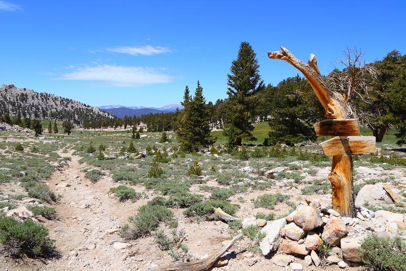
Figure 3-4.9: 到達Cottonwood Pass,右轉往北走一小段路就會到達Chicken Spring Lake。
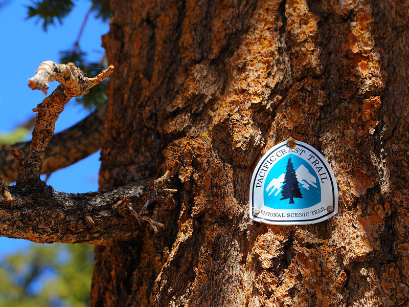
Figure 3-4.10: 從Cottonwood Pass到Chicken Spring Lake的這一小段路同時也是PCT。
爬坡主要集中在到達Cottonwood Pass前約1 mile的上坡switchbacks,之前的路是緩緩的上坡。在到達Cottonwood Pass後走個約0.5 mile的緩坡就會到達Chicken Spring Lake,而這一小段路對一些人來說是個bonus,因為這段路屬於PCT的一部分,而且可以在步道旁的foxtail pine上看到PCT的logo,如Figure 3-4.10所示。
Chicken Spring Lake是個cirque lake,雖然說湖對岸斜坡的碗公樣貌不是很標準就是。這湖說實在的並不特別,Eastern Sierra比這湖漂亮或更有特色的大有多在。不過當天的現場氣氛相當好,大部分時候只有一對帶著狗到這紮營的backpackers,看著他們跟狗玩耍且享受這一大片寂靜的自然環境,給人一整個結廬在人境而無車馬喧的感覺。
雖然湖光山色不算特別,但走這一趟有其他亮點。除了可以走一小段PCT,這也是個很適合欣賞與學習foxtail pine這不常見松樹的步道。這整段路應該只會看到兩種松樹,一種是lodgepole pine,步道前半段看到的大都是這樹;另一種是foxtail pine,從步道後半段開始以switchbacks陡上坡的路越來越容易看到,而從接近Cottonwood Pass到Chicken Spring Lake的這段路兩旁看到的幾乎都是foxtail pine,而湖邊所有的樹也應該全都是這松樹。

Figure 3-4.11: 眼前這些樹都是foxtail pine。

Figure 3-4.12: 之前對我超車的couple站在Chicken Spring Lake前欣賞風景。
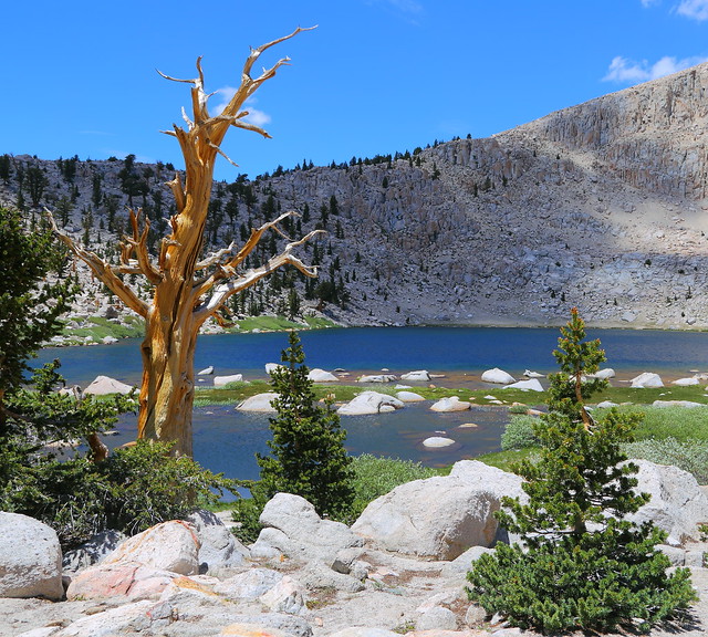
Figure 3-4.13: 這棵湖邊死掉的foxtail pine很有Great Basin bristlecone pine的味道。

Figure 3-4.14: 很多人喜歡national forest的一個原因是可以帶狗到backcountry,因為national park不允許帶狗hiking到這類的地方。

Figure 3-4.15: 很有結廬在人境而無車馬喧的氣氛。
要分辨lodgepole pine (Pinus contorta)與foxtail pine (Pinus balfouriana)非常容易,lodgepole pine是二針松而foxtail pine是五針松,而foxtail pine的整串葉子狀似狐狸的尾巴,是另一個容易分辨的特徵,也是為何這樹會被稱為foxtail pine的原因。
如果你是Great Basin bristlecone pine (Pinus longaeva)的粉絲,foxtail pine是另一個你也該關照的松樹,尤其是你去過US-395另一側Ancient Bristlecone Pine Forest的話。如果你有仔細去觀察這兩種樹,會發現他們長得非常類似,不過foxtail pine的松果不像bristlecone pine長小刺;雖然這兩種樹都有半死半活的樣子,但bristlecone pine的死氣通常較重,災難性看起來也較強。此外,foxtail pine長得相對較粗壯,bristlecone pine的樹幹通常沒有foxtail pine那麼粗。
雖然說能看到foxtail pine的地方還不少,Chicken Spring Lake這附近的foxtail pine是我最喜歡的地方之一,幾個以湖當背景的角度看起來相當不錯。這樹也可以在Sequoia National Park的高海拔區域看到,巷子內的人可能還會跟你說Sequoia National Park最大的秘密是foxtail pine,甚至還稱這樹為Sierra Nevada bristlecone pine,算是在蹭Great Basin bristlecone pine的熱度就是。

Figure 3-4.16: 好個夏日時光。

Figure 3-4.17: 回程時從Cottonwood Pass看到的Horseshoe Meadow。
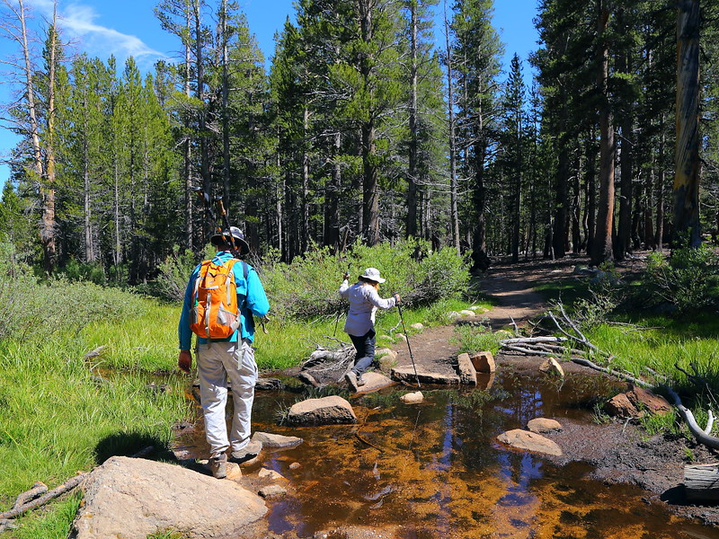
Figure 3-4.18: 一個需要但容易跨過溪水的地方。
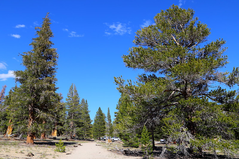
Figure 3-4.19: 前方就是步道口,左手邊這棵就是foxtail pine。

Figure 3-4.20: 也許你會發現原來你的車子就停在foxtail pine的旁邊。
如果你的體力很好,回程時可以考慮走PCT到Trail Pass,之後再回到步道口,這樣全程會變成約11 miles。我自己曾經從步道口來回Trail Pass,風景並不特別,如果你打算用這種方式走的話在這方面不要有太高的期待。Trail Pass在Wild這部電影裡有被提到,Greg在Kennedy Meadows跟Cheryl說他們選錯年走PCT,因為之前是個高雪量的冬天,幾乎所有往北走的人都在Trail Pass這地方因積雪過深被迫折返。
來回Chicken Spring Lake這段路並不算是特別scenic,但有PCT與foxtail pine這兩個有趣的元素,甚至還有Trail Pass這個地方可以和電影Wild做連結。我自己推薦把學習foxtail pine當作走這步道的重點,尤其是在到達Cottonwood Pass前的switchbacks,上坡覺得累時剛好可以近距離檢視一番。順利的話,也許可以在步道前段的一堆lodgepole pine裡分辨出foxtail pine,這樣一趟走下來就算是收獲滿滿。
Previous Next
[3-1. Cottonwood Lakes/Muir Lake] [3-2. New Army Pass] [3-3. South Fork Lakes/Cirque Lake] [3-4. Chicken Spring Lake/Cottonwood Pass] [3-5. Kearsarge Pass/Kearsarge Lakes] [3-6. Big Pine Lakes] [3-7. Little Lakes Valley/Morgan Pass] [3-8. Lamarck Lakes] [3-9. Bishop Pass] [3-10. Treasure Lakes] [3-11. Chocolate Lakes Loop] [3-12. Sabrina Basin/Hungry Packer Lake]
[1. Introduction] [2. Sightseeing] [3. Hiking] [4. Winter Activity]


No comments:
Post a Comment