[1. Introduction] [2. Sightseeing] [3. Hiking] [4. Winter Activity]
3. Hiking
[3-1. Cottonwood Lakes/Muir Lake] [3-2. New Army Pass] [3-3. South Fork Lakes/Cirque Lake] [3-4. Chicken Spring Lake/Cottonwood Pass] [3-5. Kearsarge Pass/Kearsarge Lakes] [3-6. Big Pine Lakes] [3-7. Little Lakes Valley/Morgan Pass] [3-8. Lamarck Lakes] [3-9. Bishop Pass] [3-10. Treasure Lakes] [3-11. Chocolate Lakes Loop] [3-12. Sabrina Basin/Hungry Packer Lake]
3-2. New Army Pass

Figure 3-2.1: New Army Pass的步道口跟Cottonwood Lakes相同,一開始走的路也相同,之後才分道揚鑣。
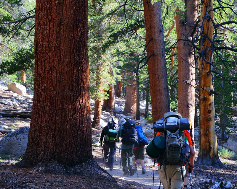
Figure 3-2.2: 這是熱門的backpacking步道,不管之後是要往New Army Pass或Cottonwood Lakes的方向去。
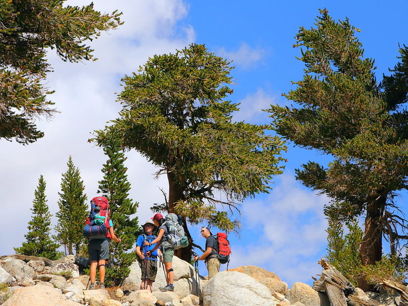
Figure 3-2.3: 不認識的山友們常喜歡在路上聊天。

Figure 3-2.4: 進入Cottonwood Lakes Basin,這樹是foxtail pine,樹的上半部已經幾乎死掉,下半部看起來算健康,半死半活的樣子很像Great Basin bristlecone pine。
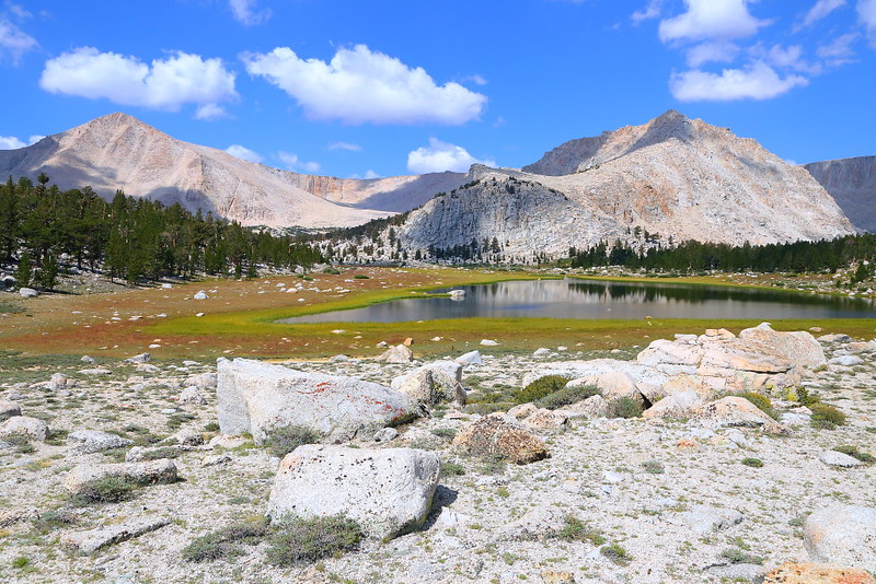
Figure 3-2.5: 這應該是Cottonwood Lake 1。
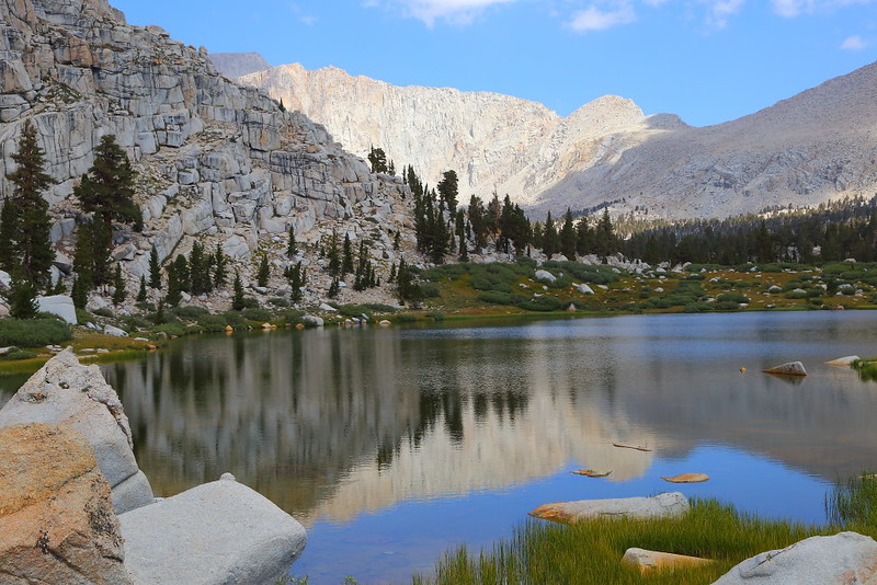
Figure 3-2.6: 離開Cottonwood Lake 1不久就會看到Cottonwood Lake 2。
Cottonwood Lakes的步道口也可以走到其他地方,而New Army Pass是另一個很有挑戰性的day hiking地點。從步道口來回New Army Pass的來回距離是15 miles,爬升約2,400 feet到最高點12,315 feet,高海拔加上路遙且陡,當天來回需要很好的體力,用backpacking分天進行可能會是較好的做法。
用Eastern Sierra的標準,這難度算很標準而不是最難的,但對大部分的觀光客來說是自己找罪受。體力沒那麼好的話可以Long Lake、High Lake或是叉路上的South Fork Lakes與Cirque Lake當終點,難度比走到New Army Pass容易不少,但依然需要夠好的體力。總之,走這步道的仍然是以山友或是當地居民為主,經驗上backpacker的比例比day hiker要來得高。
跟走去Cottonwood Lakes相同,得先走完4 miles左右的上坡路,之後會從另一側進入Cottonwood Lakes Basin並看到Cottonwood Lake 1與Cottonwood Lake 2,是辛苦一陣子後可以欣賞風景並稍作休息的路段。繼續走會緩緩上坡到達Long Lake與High Lake,這兩個湖看起來都不錯,不想繼續走的話是可以就此當終點。如果你的目標是當天來回New Army Pass,可能沒有太多的心情在這逗留,之後還有一段艱辛的上坡得克服。
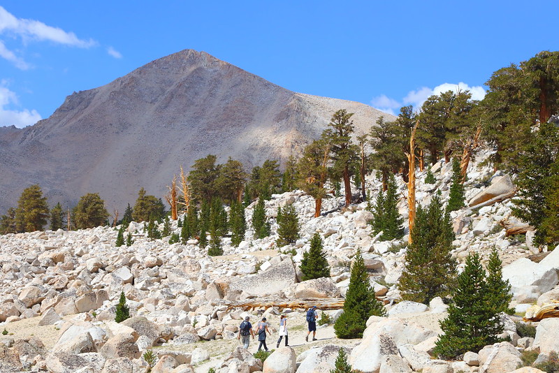
Figure 3-2.7: 這些樹不是lodgepole pine就是foxtail pine。

Figure 3-2.8: 經過Long Lake這很菜市場名稱的湖。
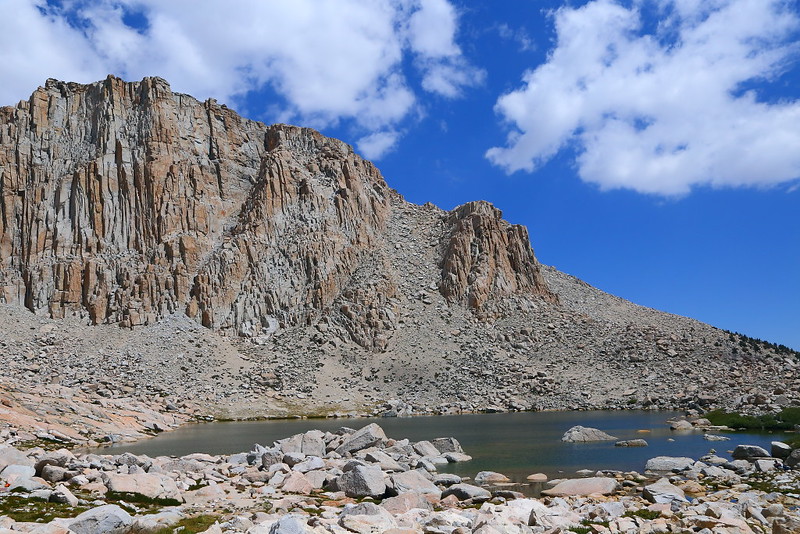
Figure 3-2.9: 繼續往上走會經過High Lake,這湖走孤寂風格。
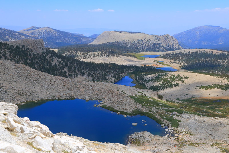
Figure 3-2.10: 爬到夠高後可以看到之前的湖,最前面的兩個是High Lake與Long Lake,之後那三個應該是South Fork Lakes。
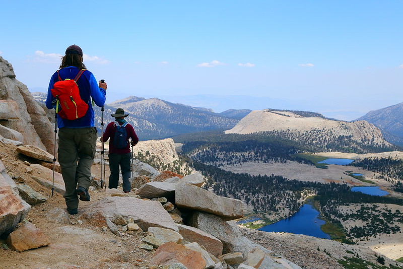
Figure 3-2.11: 走到這的海拔差不多有12,000 feet,離New Army Pass已經不遠。

Figure 3-2.12: 終於到達New Army Pass,也是Inyo National Forest與Sequoia National Park的交界。
這段High Lake後的上坡路得爬到12,315 feet的最高點New Army Pass,住在平地的人大都會感受到高海拔空氣稀薄的影響,比如腿很重、走起來很喘、頭痛或是當天晚上睡不著覺等等。好消息是在爬得夠高後可以看到如Figure 3-2.10的俯視風景,反正覺得累就稍作休息並欣賞腳下的風景,持續前進總是走得到最高點New Army Pass。
既然這地方叫做New Army Pass,表示之前已經有個地方叫做Army Pass,就在稍微北邊約0.5 mile的地方。不幸的是Army Pass那地方的積雪融得慢,讓人很難pass,因此之後改道至現今的New Army Pass。這步道是當年美國陸軍管理Sequoia National Park時蓋出來的,所以名子相當陽剛,跟Generals Highway、General Sherman、General Grant完全是同一個調調。如果你查一下地圖,會發現這隘口附近還有Soldier Lakes與Major General這種地名。
Sierra Crest有幾個可以(相對)容易穿越兩側的隘口,New Army Pass是其中之一,也是Inyo National Forest與Sequoia National Park的交界。對大部分的day hiker來說,很難繼續往Sequoia National Park走多遠,需要靠backpacking才能夠在這國家公園的backcountry深入探索。
New Army Pass這地方處在tree line上的alpine zone,別說樹長不出來,連草都很難在這生長。視覺感受相當孤寂且毫無生意,所謂的lonely planet大概就是如此吧!這地方也可以看到48州的最高峰Mount Whitney,不過這角度看起來沒有比從US-395上Lone Pine這小鎮好看就是。也許早個兩、三星期走到這地上還會有一些積雪而較好看,但爬高時路上可能會有積雪而增加危險性(帶個traction device之類的會有幫助),要兼顧風景與安全並不總是那麼容易。
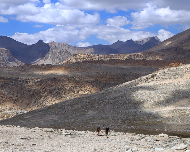
Figure 3-2.13: 這地方屬於Sequoia National Park,因為已經在樹線之上,一整個毫無生意的月球表面類型景觀,右邊那個被光打亮緩緩上升的山頂就是48州最高峰Mount Whitney。

Figure 3-2.14: 有千山我獨行的fu。
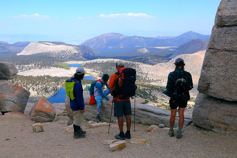
Figure 3-2.15: 這群人在這休息並準備下山。

Figure 3-2.16: 高處算是樹長不出來的alpine zone,繼續往下走就會變成樹剛可以長出來的subalpine zone。

Figure 3-2.17: 回到比較有綠意的Long Lake。
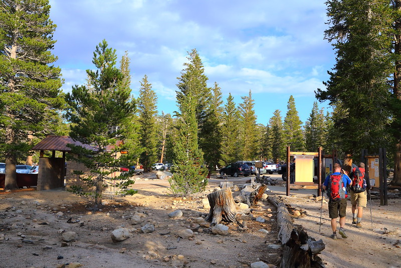
Figure 3-2.18: 回到步道口。
Sequoia與Kings Canyon這兩個國家公園的backcountry被刻意保護,也就是不蓋像Yosemite的Tioga Road讓大家可以用開車的方式輕鬆欣賞風景,因此可玩性對大部分的人來說較低。但如果你身強體壯外加美國時間多,可以從Eastern Sierra進入公園而看到大部分人沒看到的景緻,對這兩個國家公園的評價也會高很多。
如果你對Kings Canyon的backcountry有興趣,可以嘗試Kearsarge Pass與Bishop Pass這兩個也是Eastern Sierra的熱門步道。這幾個進入Sequoia與Kings Canyon的隘口海拔都在12,000 feet左右,大約需要在七月中之後積雪才能融到夠少適合行走,要走之前最好先查一下步道狀況。
視覺上來說,New Army Pass比Cottonwood Lakes豐富很多,不過對體力的需求也比較高,尤其是要當天來回的話。我覺得兩個地方都值得走,看自己當時的體力、心情、步道狀況與天氣。不想太操的話,Cottonwood Lakes是比較好的選擇,可以在湖邊就地搞些比如調素琴閱金經(要念心經當然也可以)的輕鬆活動,玩夠了再走回步道口。
Previous Next
[3-1. Cottonwood Lakes/Muir Lake] [3-2. New Army Pass] [3-3. South Fork Lakes/Cirque Lake] [3-4. Chicken Spring Lake/Cottonwood Pass] [3-5. Kearsarge Pass/Kearsarge Lakes] [3-6. Big Pine Lakes] [3-7. Little Lakes Valley/Morgan Pass] [3-8. Lamarck Lakes] [3-9. Bishop Pass] [3-10. Treasure Lakes] [3-11. Chocolate Lakes Loop] [3-12. Sabrina Basin/Hungry Packer Lake]
[1. Introduction] [2. Sightseeing] [3. Hiking] [4. Winter Activity]


No comments:
Post a Comment